“He said, “Americans look upon water as an inexhaustible resource. It’s not, if you’re mining it.” – John McPhee, Assembling California
If you live in southern California and read the news, you’ve probably heard about the Cadiz Water Project. The basic premise behind the project is to pump groundwater out of the Cadiz Valley in the Mojave Desert and pump it into the Colorado River aqueduct, thus delivering it to the Los Angeles Basin. For thirsty Angelenos, this seems like a great solution, and to paraphrase the old adage, if the source of the water is out of sight, it’s also out of mind.
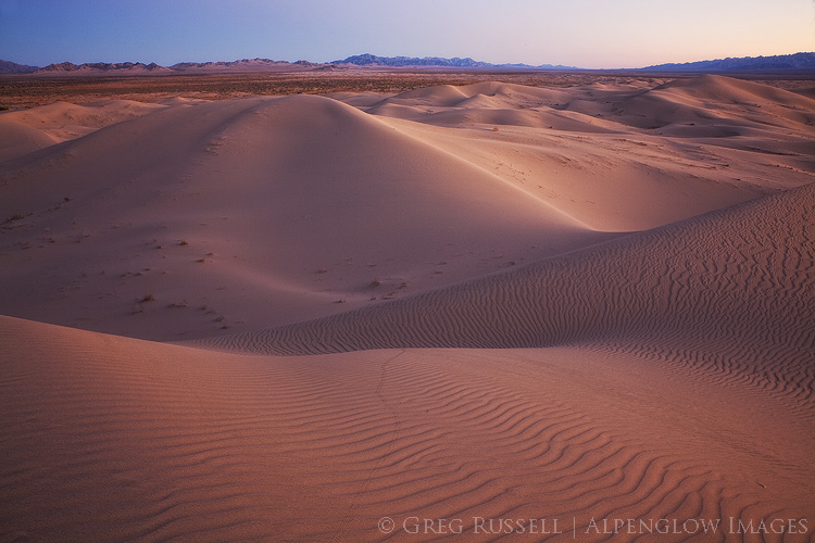
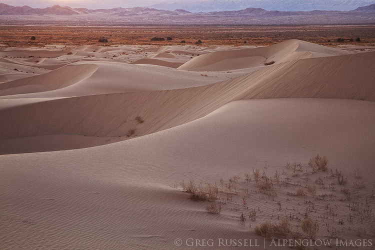
The Cadiz Valley is also home to the Cadiz Dunes Wilderness, which is primarily made up of the Cadiz Dunes complex and portions surrounding valley. A large part of the Cadiz Valley–including the Wilderness–are part of the Mojave Trails National Monument, which was designated in 2016. Because of increased news coverage, two friends and I recently went to the Cadiz Valley to photograph the dunes and experience the place first-hand.
The Cadiz Valley is a typical Basin and Range valley. It is surrounded by the Sheephole Mountains to the west, the Ship Mountains to the north, and the Old Woman Mountains to the east. A lake, which has long since dried up, once occupied the entire valley; blowing sand has created the Cadiz Dunes complex. Because of the minerals the lake left behind, several salt mines have popped up in the southern end of the valley. A railroad right-of-way also runs through the valley, connecting historic Route 66 with Parker, Arizona. When we visited, we drove for over 60 miles on unpaved roads and didn’t see another vehicle. As Mark said, “in southern California, that’s a pretty good indicator that you’re way out there.” Indeed, I bet it’s highly unlikely that many desert travelers give the Cadiz Valley much thought.
The Cadiz Water Project
An interesting thing about the valley, and the reason it’s front-and-center in Los Angeles’ water politics, is the large aquifer that lies beneath it. Cadiz Inc., which owns several thousand acres in the valley, has proposed to pump water from the aquifer, and through a 43-mile-long pipeline, move it to the Colorado River aqueduct so it can be transported to the Los Angeles Basin. The Cadiz Valley Water Conservation, Recovery and Storage Project–or Cadiz Water Project–has met with poor investor interest, court battles, and seemingly endless hurdles.
Last fall, however, the project got a new head of steam. David Bernhardt, a former partner at the law firm representing Cadiz, was confirmed as the Deputy Secretary of the Department of the Interior (in unrelated news, the Department of Interior also rolled back legislation limiting the use of railroad right-of-ways so the pipeline could be built) and a bill in the California state senate that would have shut down Cadiz was voted down by senate Democrats. There are still legal battles taking place, but this plan has a real possibility of happening.
Silly, and dangerously antiquated
Cadiz Inc. owns the rights to 50,000 acre-feet of water per year for the next 50 years; that’s 50,000 acre feet being pumped out of the ground each year and into the aqueduct. The aquifer is only replenishing itself at a rate of 32,000 acre feet per year. Cadiz also estimates the cost of their water between $775-$960/acre foot; the current price the Los Angeles Municipal Water District charges is $670/acre foot. Thus, water coming from this project would cost the consumer more. Finally, the water Cadiz plans on pumping out of the aquifer contains the carcinogen hexavalent chromium. They argue that by diluting it in Colorado River water, levels of hexavalent chromium would be safe for human consumption. Finally, in seismically active southern California, any pipeline is going to require expensive maintenance.
Although the Colorado River aqueduct is an engineering achievement, it is admittedly antiquated and unsustainable. So is the Los Angeles aqueduct that brings water from the Owens Valley. For a truly sustainable solution to water woes, we need to be looking closer to the point of use: desalination plants, and water recycling make much more sense than piping water from hundreds of miles away.
Thinking past the wilderness boundaries
A federally designated Wilderness is by definition a place of compromise. Its boundaries have been drawn as lines on a map based on public comments, input from all interested parties, and after a vote on its designation by people who will likely never see the place, or think about it again. Nevertheless, this is one of my favorite levels of protection for a place because it ensures that the land will remain as pristine as possible for generations to come. But tonight my mind is concerned with what lies beyond the edge of Wilderness boundaries. What of that landscape?
An edge, as defined by ecologists, is a place of transition between habitats: forest and meadow, for example. Deer and other herbivores can often be found along edges; they stay close to the cover of the forest, while enjoying the ability to graze in a meadow. For a hungry predator, this can be a place of incredible opportunity, but for distracted prey edges can be a great danger. Indeed, the future of the Cadiz Valley is not really all that different from a deer grazing at the edge of a meadow.
Standing on the Cadiz Dunes at sunset, looking east across a creosote sea towards the Old Woman Mountains, I was reminded why we visit these places. The road we drove in on was somewhere in front of me, but was rendered invisible due–if nothing else–to the vastness of the landscape. I found myself caught in one of those moments when the silence was deafening. In this big landscape, I was reminded of just how small I am, re-instilling my sense of humility. Looking out across the arbitrary lines protecting the Wilderness, my eyes try to imagine the dust from pipeline construction or the shimmer on the horizon from a body of evaporating water–the result of a pipeline spill. My ears try to hear the sound of pumps in the distance, sending groundwater on their long journey to Los Angeles.
The Cadiz Water Project would provide additional water to Los Angeles for 50 more years. Fifty more years to ruin a beautiful desert valley and search for another aquifer we can mine water from.


I just read about the State of California water district going to take a lot of water from the Cadiz Valley and can not believe it is right next to Joshua Tree Nationals Park. Taking the amount of water is going to kill Joshua Tree National Park and it will no longer be there for all citizens to enjoy it. It’s also very close to Lake Havasu so I guess California is going to turn the whole area into another Owens Valley. Glad I am in my mid-60s because in 10 years, the southern end of the State of California will be noting but a waste land, just like Owens Valley. How nasty!