Arizona

...now browsing by category


Black rocks protruding up

Friday, July 5th, 2019

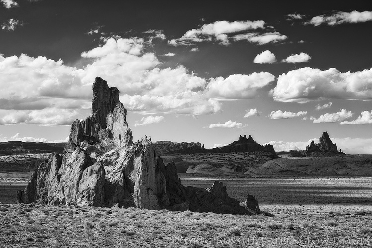
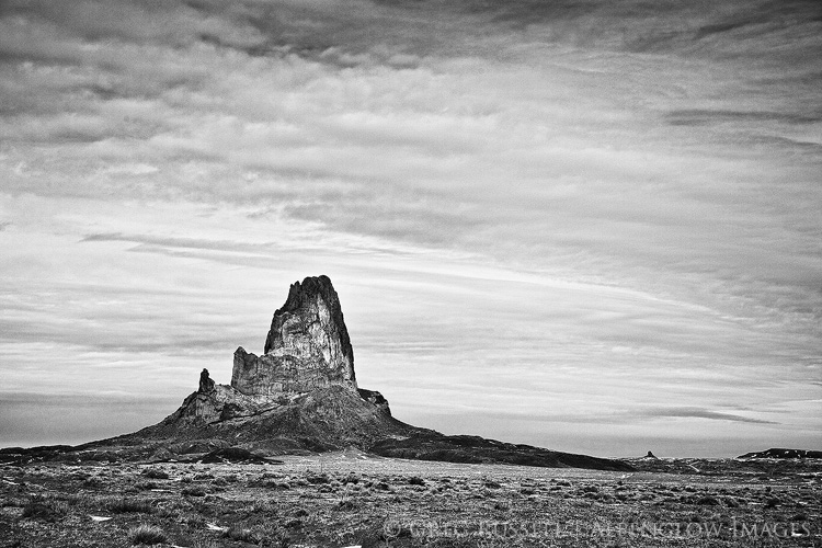
The Navajo or Diné Volcanic Field is a circle of volcanic formations lying roughly in the Four Corners region of the American Southwest. These peaks and ridges are striking in their own right, but are even more curious because of their juxtaposition with our image of what the Colorado Plateau should be.

The Colorado Plateau is synonymous with sandstone. We identify this region by massive cliffs, arches, hoodoos, and towers; people come from all over the world because there is nothing like these places anywhere else on Earth. It seems a bit incongruous, then, to drive through this region past numerous large volcanic towers, all of which stand in stark contrast to the surrounding sandstone formations.

Agathla Peak, part of the Diné Volcanic field in northern Arizona
Agathla Peak–Aghaałą́–near Monument Valley in northern Arizona

Black rocks protruding up

About 30 million years ago, as the rest of the Colorado Plateau was rising, several volcanic explosions occurred in northern Arizona and New Mexico. They occurred from Kayenta and Comb Ridge eastward to the Lukachukai Mountains and northwest New Mexico. From there, the semicircle of violent volcanic eruptions turned southward towards Zuni Pueblo. The plugs and dikes were covered for millions of years, but erosion has uncovered and sculpted these features, leaving behind the desert towers we know today. The Navajo simply refer to these towers as ‘black rocks protruding up’–tsézhiin ‘íí ‘áhí.

Black and white image of Church Rock, near Kayenta, Arizona
Church Rock with Agathla Peak in the background

Diné ethnogeology

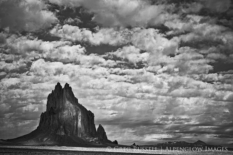
In spite of its obscurity in a sandstone world–or perhaps because of it–tsézhiin ‘íí ‘áhí has a strong presence in Diné mythology. Ship Rock–Tsé Bitʼaʼí–the landmark monolith in northwestern New Mexico, for instance, is told to have been home to a giant winged monster or bird, Tsé Nináhálééh. Tsé Nináhálééh was one of many monsters that followed the Diné to their current homeland–Dinétah–when they emerged to this world from the previous one. This bird was vicious, and would throw its prey into mountainsides and rocks, crushing them before eating them.

Monster Slayer (Nayé̆nĕzganĭ) was one of two sons of Changing Woman, Yoołgaii Nádleehé, who fought and battled these monsters. He had a magic feather that protected him from the giant winged monster’s attacks and was able to defeat it. Today, Ship Rock itself is thought to be the body of the winged monster; the volcanic ridges running out to its sides are thought to be the monster’s wings.

Black and white image of shiprock in northern New Mexico under a partly cloudy sky
Ship Rock–Tsé Bitʼaʼí–where Monster Slayer destroyed the winged monster

The Diné volcanic field is the perfect example of how geologic features and obscurities capture our attention and work their way into our cultural DNA. A region’s geology plays a huge role in its phenology, giving rise to many of the things we relate to in the places we love (trees, flowers, even animals), even if the geology itself goes unnoticed. Stories are told, and are passed down through generations. These stories are what root us in a place. This is another way we as photographers are very much storytellers.

This intersection between geology, folklore, and sense of place has really captured my attention lately and I hope to write more about it. In the meantime, how has geology influenced your sense of place?

*The Navajo Creation Story is one drawn from several stories, many of which can only be told respectfully during the winter months. There are several texts that have attempted to pull these stories into one cohesive book. An excellent summary can be found here.

Happy 100th birthday to Grand Canyon National Park

Tuesday, February 26th, 2019

“The wonders of the Grand Canyon cannot be adequately represented in symbols of speech, nor by speech itself. The resources of the graphic art are taxed beyond their powers in attempting to portray its features. Language and illustration combined must fail.” – John Wesley Powell


Aside from a few family vacations when I was young, I only have glimpses in my memory of our national parks. However, that changed when I was 13 and went to Grand Canyon National Park for the first time. I visited with my Boy Scout troop on spring break for my first backpacking trip. I’m not sure of my rank in Scouting at the time, but as far as backpacking went, I was truly a tenderfoot.

Our first night, spent on the South Rim, was as snowy and cold. As such, we hit the trail the next morning with wet tents and cold feet. Two days later, I would be bailing water out of my tent for an entire afternoon in a torrential downpour on the North Kaibab trail. After a rocky start, though, the clouds lifted and we got to experience the tranquil beauty of Grand Canyon. The immense canyon showed us all four seasons over just a few days. I came out filthy, exhausted, and addicted. Addicted to our national parks, to the wilderness ethos, to a life dedicated to the outdoors. That trip changed my life, and I’m grateful for that.

Grand Canyon National Park remains one of my favorite places, and today is its 100th birthday! Over the course of its time as one of the crown jewels of the national parks, it has inspired millions. With the help of fellow defenders, Grand Canyon has weathered storms of its own. Tourism development, mining, and even dams have threatened Grand Canyon at some point during its tenure as a national park. Threats continue: there are active proposals to open portions of Grand Canyon to uranium mining (despite a ban currently in place). Grand Canyon National Park is also leading the way in acknowledging the long history of indigenous people in our national parks.

Despite the threats, one cannot help but stand in awe when faced with such immensity. Grand Canyon takes the visitor back in time, looking through Kaibab limestone, Coconino sandstone, Redwall and Muav limestone, and finally down to the bottom–to Vishnu schist, some of the oldest rock on earth. You can’t help but feel small there. The resilience and humility it instills in us makes Grand Canyon worth celebrating.

Here are a few of my favorite images from Grand Canyon over the years.

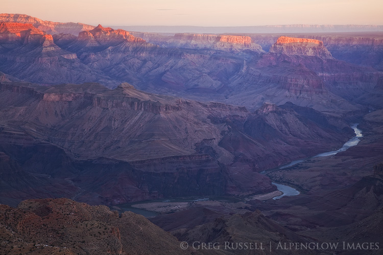
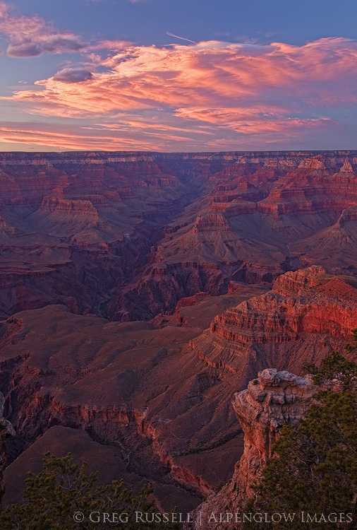
desert view sunrise, grand canyon national park
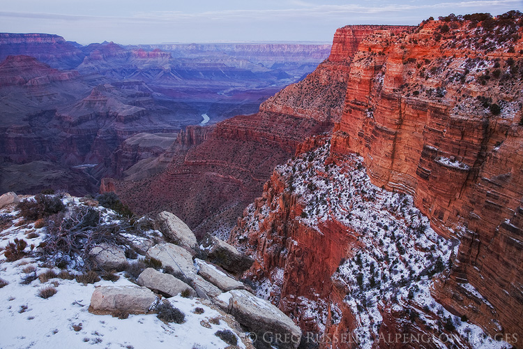
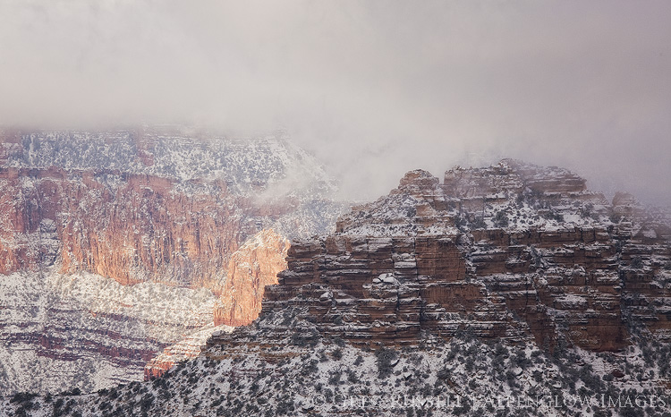
A winter evening at the south rim of the Grand Canyon
A dramatic sunset over the Grand Canyon, near Mather Point.  In this image, the South Kaibab Trail, Phantom Ranch, and the Tonto Shelf are all visible.  Grand Canyon National Park, Arizona
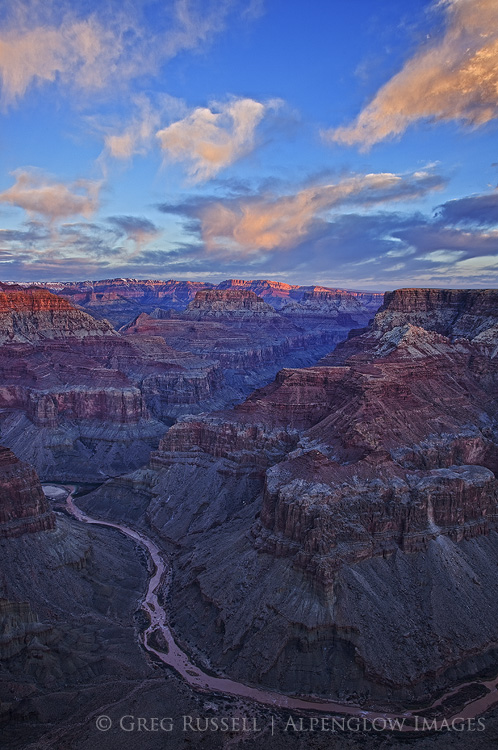
photo of sunrise with bright orange clouds and two rivers converging in a deep canyon
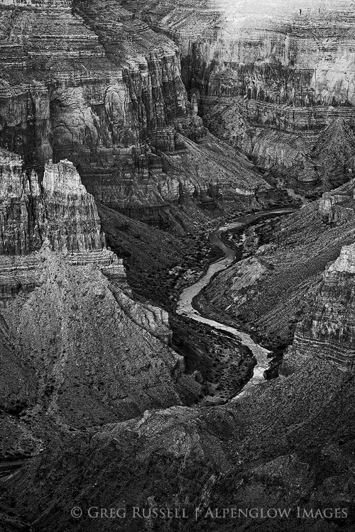
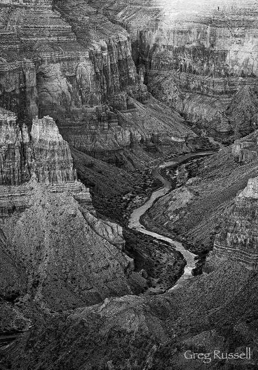
black and white photo of the little colorado river gorge as soon from the grand canyon south rim
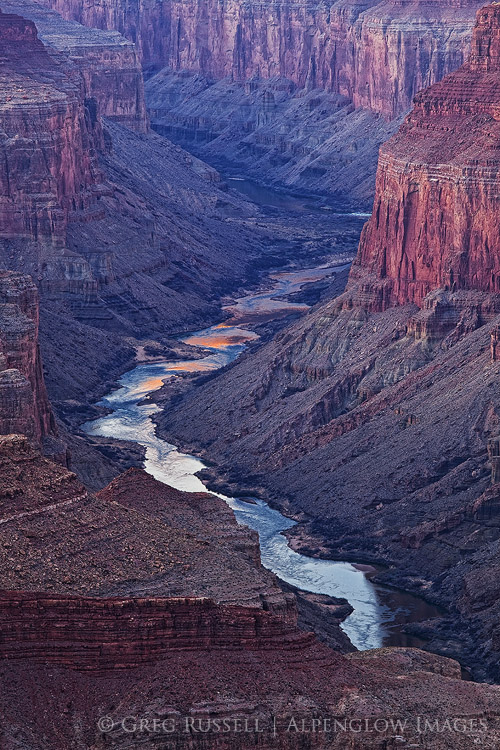
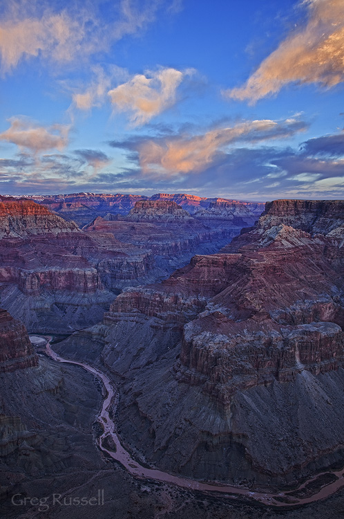
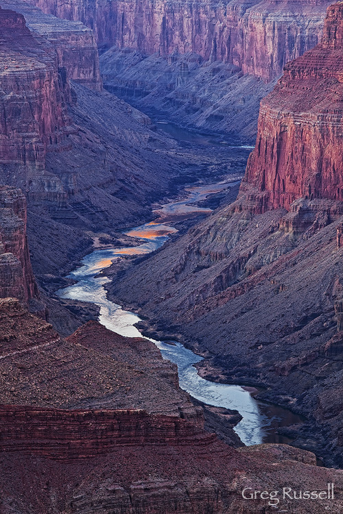
colorado river near cape solitude in grand canyon national park

Closed for business

Friday, January 25th, 2019

“If God does not exist, everything is allowed.” – Dostoyevsky’s Ivan Karamazov


If you’ve been following the news at all, you know that the US government is in the midst of the longest shutdown in its history. I have no interest in talking about the politics of it except to point out that the poster child of the shutdown has been our public lands, specifically our national parks. Trash, vandalism, and more in our popular parks have made national news, almost since day one of the shutdown. What should our land use ethic be when there is no regulating body present? Should we continue as if nothing has changed, or should we alter our approach?

The importance of our national parks can’t really be underscored enough. States, communities, and private organizations have rallied to keep our biggest national parks open during the shutdown. Grand Canyon, Bryce, and Zion and three great examples of this collective effort. The revenue these parks bring in is obviously a big factor in determining whether or not to keep them open. In the case of Zion, Utah State Route 9 runs through the middle of the park; accessibility is another factor. Another thing we can’t ignore is the importance of these places to us all. Shutting them down would–on some level–be heartbreaking.

Two weeks into the shutdown, my wife and I were married on the lawn at the Zion Lodge. It’s kind of an inarguable point that we had selfish motivations for seeing Zion remain open. What if Zion had closed for the shutdown? While disappointing, we would have understood and moved our wedding to a ‘plan B’ location.

After our wedding, we took a short road trip to Moab, Monument Valley, and the Grand Canyon. Due to a lack of resources to plow snowy roads, Arches National Park was closed. Fortunately, Moab is full of opportunities for public lands recreation. Perhaps more disappointing was that Moab Brewing Company was also closed for maintenance! The Grand Canyon–of course–was open, and functioning more or less normally.

One would assume, government shutdown or not, that the people who visit our national parks and monuments would be the caretakers, the proud public land owners. Maybe that isn’t the case though. Incidents of vandalism are rampant, perhaps the most egregarious being the chain-sawing of Joshua Trees in their namesake national park. In Zion, we witnessed people were parking on sensitive plants in the Canyon. Dogs (often off leash) were on almost every trail. It’s clear that, in the absence of enforcement, we don’t care about the rules at all. Or, to put it another way, it’s the enforcement of rules that makes us look like a good society, not an inherent quality of society itself.

Alain puts it beautifully in his Letters to Sergio Solmi on the Philosophy of Kant: “Ethics means knowing that…we have certain obligations. Ethics is neither more nor less than a sense of dignity.” Should I litter, destroy, and vandalize our national parks? It would be unworthy of me–unworthy of what humanity has become, unworthy of the education I have been given, unworthy of what I am and wish to be. I therefore refrain from such behavior. These are my ethics.

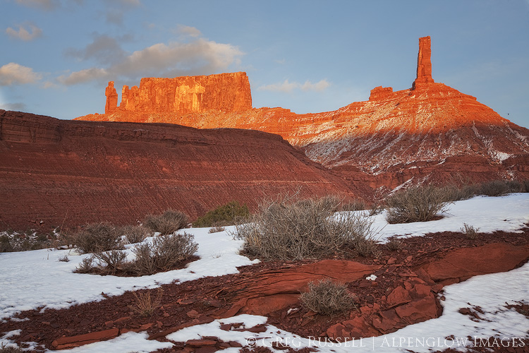
golden light is cast on Utah's Castleton Tower & The Rectory.

Should our national parks close for business completely during the shutdown? The former Director of the National Park Service certainly thinks they should be. The Mojave Desert Land Trust does too.

My ethics remain unchanged in this time of the government shutdown. I have visited national parks during this time. I am also aware that I am adding to the congestion that is partially the root of these problems. In her book The Hour of Land, Terry Tempest Williams writes, “Awe is the moment when ego surrenders to wonder. This is our inheritance – the beauty before us.” Perhaps even more so than the heartbreak of having our national parks closed is that of seeing our collective ego so big that we are willing to destroy them to satisfy ourselves.

Nearly two years ago, I wrote about my code of ethics as a photographer. We can add to that list now to suggest that we always tread lightly–even when the government is open, do not take services for granted. Pack out trash, and always be mindful of road and trail closures. Photographers can (and should) set the example of how we should treat our public lands; no photograph is worth endangering the integrity of a place, and realizing the fragility of our heavily visited national parks is paramount.

Lay of the Land

Friday, September 9th, 2016

“To rise above tree line is to go above thought, and after, the descent back into birdsong, bog orchids, willows, and firs is to sink into the preliterate parts of ourselves.” – Gretel Ehrlich


The entire summer seemed busy, but August flew by at an unusually rapid pace. My son and I drove from California to New Mexico to visit my parents; on our way out there we broke up the drive by spending a quiet and welcoming night at Navajo National Monument in northern Arizona. Four days after getting home from that trip, my girlfriend and I left on a trip to the north coast of California, visiting friends and family along the way. That leg of our travels culminated at South Lake Tahoe (I know, it’s not the north coast. Don’t ask.), and my dropping her at the airport in Reno to fly home.

From there, I drove south to eastern California, picked up Jackson Frishman at his house in the Deep Springs Valley, and we headed to eastern Nevada to backpack and photograph some Great Basin mountain ranges. By the time I got home from my second trip, my car had more than 3,000 new miles and I guess you could say I really got the lay of the land.

Over the years I’ve spent outdoors, I’ve become acutely aware of moments where time seems to stand still and that particular snapshot in time seems to transcend all others. In those particular rare moments, I’m overcome with an almost indescribable peace, feeling as though there’s no other place on earth I would rather–or should–be. I imagine that Buddhists would describe these moments as feeling very much like Nirvana, when one’s soul is freed from continuous rebirth, thus permanently taking its small place in the world. Put another way, these moments represent true peace.

I’ve always liked the above passage by Gretel Ehrlich because I think perhaps she used tree line as the metaphoric “rising above,” which has always seemed more eloquent than any way I’ve found to describe the feeling. My August travels only took me above topographical tree line a couple of times, but I felt like every turn of the journey somehow took me above Ehrlich’s metaphorical tree line, and I am indeed very fortunate for that. Here are a few of my favorite images from the last month or so.

engineer-mountain-wildflowers

Wildflowers in Colorado’s San Juan Mountains

navajo national monument sunrise

August sunrise in northern Arizona.

fort-bragg-coastline

Coastline along the rugged north coast of California

mendocino headlands sunset

A foggy sunset along California’s north coast

white mountains california

Sunrise over the Deep Springs Valley, California

white pine mountains sunset

Sunset on Currant Mountain, Nevada

Public Comments on the Grand Canyon Escalade Project

Thursday, September 1st, 2016

Earlier this week, Bill 0293-16 came before the Navajo Nation Council for approval. This bill contains the much-contested Grand Canyon Escalade Project, which is a massive development project on the east rim of the Grand Canyon near Grand Canyon National Park and the confluence of the Colorado and Little Colorado Rivers. Grand Canyon Escalade would be destructive on several levels, and I believe it should be opposed. The nonprofit group Save the Confluence has much more about the project on their website. 

The Navajo Nation Council is asking for public comments on the bill until 9/3/16 (which is not much time). You can submit your comments directly to the council by emailing them at comments@navajo-nsn.gov, with Bill 0293-16 in the subject line. 

Here are the comments I sent the council regarding Grand Canyon Escalade this morning.

Esteemed council members:

I am writing regarding the proposed Grand Canyon Escalade Project, which is up for approval as part of Bill 0293-16 and is currently before you.  As I understand it, the bill asks for approval of several items, including significant development of an area on the Grand Canyon’s east rim, near the confluence of the Colorado and Little Colorado Rivers, near the border of the Navajo Nation and Grand Canyon National Park. I understand this project would bring tourism and revenue to the Navajo Nation and as a non-tribal member of the community, I cannot speak for what the confluence means to the families and clans who live west of Highway 89. Nonetheless, I submit my comments for your consideration.

As places go, the Grand Canyon has faced its share of threats, and fortunately it has dodged some of the biggest ones (like the Bridge and Marble dams, whose progress was halted permanently in 1969). Today it seems like the West along with many other concerned people around the world is again holding its breath to see how the Grand Canyon Escalade Project will play out.

In 1993, I came to the Grand Canyon for the first time with my Boy Scout troop from Farmington, New Mexico. We backpacked into the Canyon from the South Rim; it was my first backpacking trip and I made many lifelong memories. Since then, I have become an avid backpacker, even taking my son into the wilderness for the first time when he was two. In an increasingly busy world, wilderness provides solitude, solace, and sanctuary. I have returned many times to the Grand Canyon since 1993 and in 2013 (twenty years after my first visit) I again found myself backpacking the Grand Canyon, only this time I was hiking to Cape Solitude to see the confluence–and the proposed site for Grand Canyon Escalade–myself.

The trip was impactful for me, and it became even more clear why the Grand Canyon Escalade simply cannot happen. During the entire trip–which comprised over 40 miles of hiking–we did not see an another human, not even another human footprint. We crossed paths with a herd of elk several times, but beyond that the silence was deafening and the dark night sky mesmerizing. The loneliness was aching and beautiful. Indeed, the area of Grand Canyon National Park that Cape Solitude lies in only sees about 50 visitors a year, which is a far cry from the much more busy main corridor along the South Rim; it feels like it is a world away.

Grand Canyon Escalade would be putting undue stress on an ecologically sensitive area and destroying one of nature’s cathedrals that has been billions of years in the making. This part of the Grand Canyon doesn’t need a lot of visitors for it to be special. Wilderness is like that. As much as we need food or water, I believe we need wild places. We do not need to visit them often, and when we do they should be difficult to get to, but simply knowing these places are there calms the nerves in the hustle and bustle of city life.

One night, decades ago, the famous Western author Edward Abbey sat at Cape Solitude and wrote, “We must preserve, not obliterate, what still remains of the American wilderness, the American hope, the American adventure.” Restraint is one of the rarest of virtues, but I ask that you exercise it here, thus preserving the east rim of the Grand Canyon, untouched and unmarred, for future generations.

Respectfully,

Greg Russell

Sunrise at the confluence of the Colorado and Little Colorado rivers the site of the proposed Grand Canyon Escalade project

The Confluence of the Colorado and Little Colorado Rivers

Chaos Theory

Saturday, January 16th, 2016

In walking around southern California, I notice many people are starting to doubt the legitimacy of the rain this record El Niño was said to bring us.  Fair enough…we’ve had only one honest storm so far, but meteorologists say it is really just starting to come into its own. Despite not rearing its head too badly yet here, much of the Sierra Nevada is already at 100%+ of snowpack, and wildflowers are starting pop up in the desert.  More on that in a minute though.

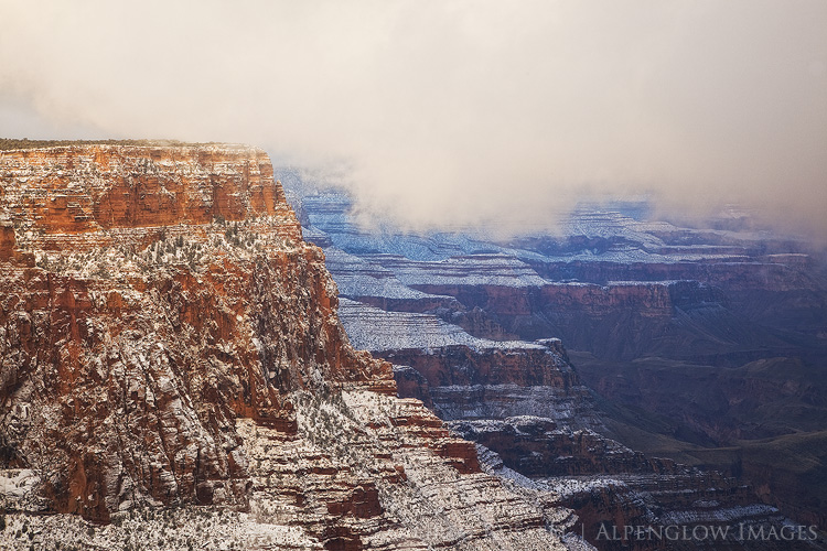
At the end of fall, right before Christmas, I made a quick trip to the Grand Canyon.  While there, I got to experience a fairly stormy day on the south rim, complete with howling winds, whiteout conditions and closed roads.  A couple of images from that trip easily made my Favorites of 2015.  Then, Jackson Frishman and I headed to Death Valley National Park, and the weather was equally spunky.  There was no snow in the valley, but there was plenty of rain, great clouds, and even a few surprises thrown in along the way.

Visiting the Grand Canyon and Death Valley so closely together in time is sort of a surreal experience.  As if I had lost it, I quickly regained my appreciation for deep geological time.  Nearly 75 million years ago during the Laramide Orogeny, the Colorado Plateau was pushed upward nearly two miles and the Colorado River (which flowed from the newly formed Rocky Mountains) started to cut into the rock, forming the Grand Canyon.  Today, the river has cut about as deeply as it can go–to the basement Vishnu Schists–giving us a look back in time about 1.7 billion years.

Death Valley’s geologic story is a bit more complex (and violent), but as the Vishnu basement rocks in the Grand Canyon were being formed, Death Valley was already in a state of unrest, with rocks in certain areas being twisted and folded.  One area of particularly complex folding has been dubbed the “Amargosa Chaos” and is found in the southern end of the Black Mountains.  Fold, fold, fold…then separate.  That’s how the Basin and Range Province creates its mountain ranges–plates are pulled apart until they tilt upward creating massive mountain ranges with deep valleys between them.  In this part of North America, as John McPhee writes, the continent is literally being pulled apart.

You also start to understand a scale of spatial immensity in these two places.  While the Grand Canyon is typically thought of as the “deep” canyon at around 6,000 feet, it’s got nothing on Death Valley, which is over two miles deep (at its deepest).  If you’re not interested geology (I know…how can you not be?), it might be just as easy to stand in awe of both of these places, allowing yourself to feel small, both as a part of the landscape, and as barely-a-blip in geological time.

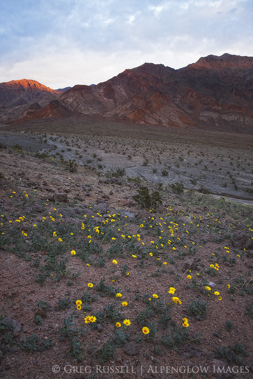
It’s worth noting briefly that while spring on the Grand Canyon’s rim is a few months off, it’s already happening in (especially) the southern end of Death Valley.  Jackson and I saw fields of Desert Gold (Geraea canescens) that created a wonderful lace-work pattern among the volcanic rocks in the southern Black Mountains.  All of the other usual suspects were starting to bloom as well, but are several weeks off from peak.  Hopefully some dreary, drizzly conditions continue in Death Valley, and it’s got the possibility of becoming a very good year for wildflowers.  Jackson has several photos and more commentary on his blog as well.

A winter evening at the south rim of the Grand Canyon

Death Valley mountains and wildflowers

Stormy winter morning on the south rim of the Grand Canyon

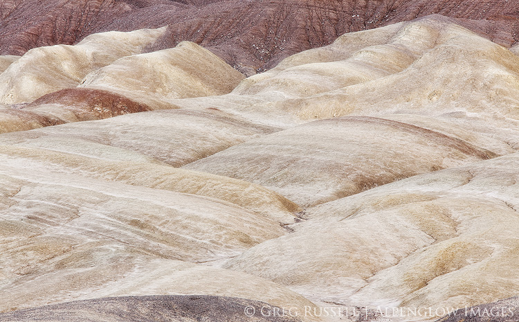
Salt Creek Hills, Death Valley

Through the Grama

Monday, February 25th, 2013

For February at 6500′, it’s a warm day–about 40 degrees–and the sun makes it feel even warmer as we hike across the windswept grassland plateau.  Snow still blankets the north-facing slopes, but the rest of the ground is free of snow, soft, and slightly muddy in places.

Everywhere, almost literally, signs of elk abound; I have never seen so many turds and tracks in one place.  This small plateau must be great winter ground for them.  I haven’t seen (or felt) any invasive Drooping Brome (Cheat Grass) in my socks all day, only native Bouteloua (Grama Grass).  Here on the Colorado Plateau, where some areas have been grazed extensively, that must be one sign of a healthy ecosystem.

Through the Grama we hike, our heavy packs weighing us down more and more, until–finally–the east rim of the Grand Canyon reveals itself to us.


Last weekend, Jackson Frishman invited me to join him on a trip to visit the confluence of the Colorado and Little Colorado Rivers.  Jackson’s proposal was ambitious: nearly 40 miles of hiking in 2.5 days, with no water along the route (we had to carry our own water cache).  He introduced it to me as a hare-brained plan, and honestly that’s all he needed to say to get me on board.

Jackson told me he wanted to visit the confluence because the Grand Canyon Escalade–a proposed tourism development on the western edge of the Navajo Nation, which overlooks the confluence.  If the project passes, it would include a tram from the rim down to the Little Colorado River (read more about Escalade here, here, and here).  For me, it was a good time to familiarize myself with this area, learn a little more about the proposal, as well as to visit the Grand Canyon again; I began my backpacking life there, and the Grand Canyon evokes many special memories for me.

Reflected light in the Colorado River

On Friday night, we discussed the final plans over beers and enchiladas, and it was clear that the stress of planning the trip had turned into excitement for what lied ahead.  We started out on Saturday morning; our packs were weighed down with a couple of extra gallons of water for the return hike.  We dropped the water underneath a couple of stiff piñon boughs to keep it from freezing, as well as to keep it away from the ravens which were surely watching us.  As we got closer to the park service boundary with the Navajo Nation, we found an old hogan, with a missing west wall; the doorway of a Navajo hogan faces east to receive the morning sun and it’s good blessings, and when someone dies in a hogan they are carried out through a hole that has been knocked in the west wall, then the home is abandoned.

After several more miles, we crested a hill and scared a large herd of maybe 200 elk out of a drainage.  They must have known about a water source that we didn’t.  We watched the elk until they disappeared into the horizon and would see them several times over the next couple of days.   The final push to the east rim was tortuous; buttes on the north side of the Colorado River were visible, but they never seemed to get any closer.  However, finally, after what felt like hours we arrived at Cape Solitude.

little colorado river arizona

Solitude indeed.  We had not seen any other human footprints all day, and aside from a windbreak built from rocks, our campsite showed no sign of other humans at all.  In the second-most-visited national park, solitude can be tough to come by.  It’s a special feeling to have a piece of the Grand Canyon all to yourself.

We woke up to a windy but beautiful sunrise the next morning and hiked back to our water cache (thankfully untouched) from the day before.  After rehydrating, I was happy to hike to our second night’s camp, closer to our trailhead, but with another private view of the canyon’s rim.  Horned larks flitting through the sagebrush and elk were our only company.  The next morning Jackson and I returned to our cars, shared a couple of cold beers, and parted ways.

sunrise at the confluence of the colorado and little colorado rivers


We hiked through the Grama–through a healthy ecosystem–to a part of the Grand Canyon only a few people get to see.  Elk tracks went right up to the rim.  I wonder if they admire the view from time to time?  In my twentieth year of visiting the Grand Canyon, I still stand in awe of the vast landscape, and can’t help but wonder if some of that awe would be diminished if I could take a tram all the way to the bottom, or if–consequently–the elk tracks didn’t go all the way to the rim.

sunset on the little colorado river gorge

P.S. You can also read Jackson’s post and see his image of Cape Solitude at his blog here.  His blog is always worth a visit, with fantastic writing and wonderful imagery.
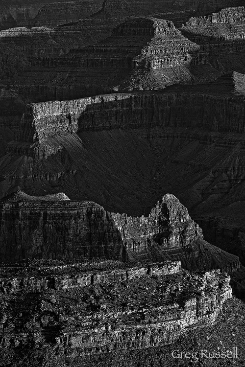
A Bird’s Eye View

Monday, July 9th, 2012

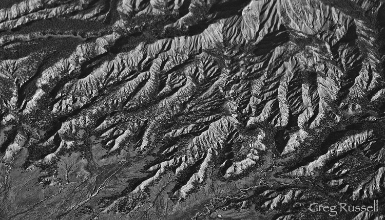
My family and I just returned from a trip to Wyoming.  The primary purpose of the trip was to visit family, so I did not have a lot of extra time for photography.  However, one of the photographic highlights of the trip was our flight from my home in southern California to Denver.  The flight path covers some fantastic topography and it’s always been fun for me to see how many formations I can recognize.  On this flight, I decided to try and do a black and white series of the landscape 35,000′ feet below me.
Can you figure them out?  Some are super easy…others are not.   Images are posted in the order you would see them flying from southern California to Denver.

Hills in the Mojave Desert of southern California

Mystery Landscape #1

Grand Canyon National Park

Mystery Landscape #2

The Vermillion Cliffs in northern Arizona

Mystery Landscape #3

Goosenecks of the San Juan River

Mystery Landscape #4

Grand Gulch Plateau

Mystery Landscape #5

Badlands in southwestern Colorado

Mystery Landscape #6

Colorado Rockies

Mystery Landscape #7

Feel free to post your guesses in the comments section.  I will post the locations in a few days.  I do not know every detail of each image, but am pretty sure I have the locations correct…maybe you can pinpoint some better than I can.

There were some challenges that degraded image quality in these files.  First, I got lucky with a pretty clean window on the airplane.  A dirty window would make these sorts of images difficult.  Second, the glass plane window and interior plexiglass also make focusing difficult.  There are some odd things that happened to some of the files because of my high tech “plexiglass filter.”   You can probably see a few things on some of these files…

I’m looking forward to hearing your thoughts on these, as well as your guesses!

Two new ‘Wind’ images

Monday, June 25th, 2012

In January, I introduced my wind portfolio, a black and white set focusing on shape and form, and celebrating landscapes that have been created (in part) by wind.  I am happy to add two new images to that portfolio.

View from Yavapai Point, Grand Canyon

Grand Canyon, May 2012

The Grand Canyon is a place that has been shaped by the powerful erosional forces of wind and water for millions of years.  Attracting millions of visitors a year, it is truly one of the seven wonders of the world, and has always captivated me.  At sunrise and sunset, the receding hill layers create depth not only in the landscape, but in the imagination, and it is difficult for me not to imagine John Wesley Powell exploring this canyon for the first time, being completely awed.


“The wonders of the Grand Canyon cannot be adequately represented in symbols of speech, nor by speech itself. The resources of the graphic art are taxed beyond their powers in attempting to portray its features. Language and illustration combined must fail.”

–John Wesley Powell


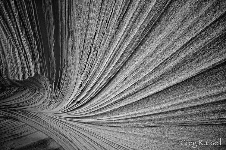
The second image is an intimate landscape from Utah’s Grand Staircase-Escalante National Monument.  If you have been in southern Utah in spring, you know the wind can blow, and you have have even felt sandblasted a time or two.  How do you think the sandstone walls feel?  The walls of this alcove have been shaped by grains of sand being blown against it for hundreds, probably even thousands or tens of thousands of years.  Beautiful cross-bedding patterns have been exposed, creating some very powerful lines.

A sandstone alcove

Sandstone Alcove, June 2012

My Wind Portfolio is special in that 25% of the sales of these prints is donated directly to the Wilderness Society and I offer special pricing when you purchase more than one image from the portfolio.  Please click here to view the entire collection.

Desert Sentinels

Friday, November 11th, 2011

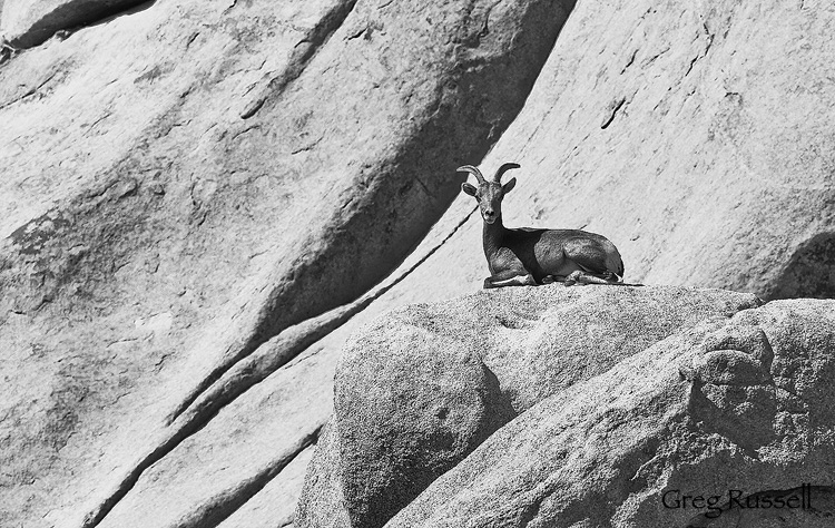
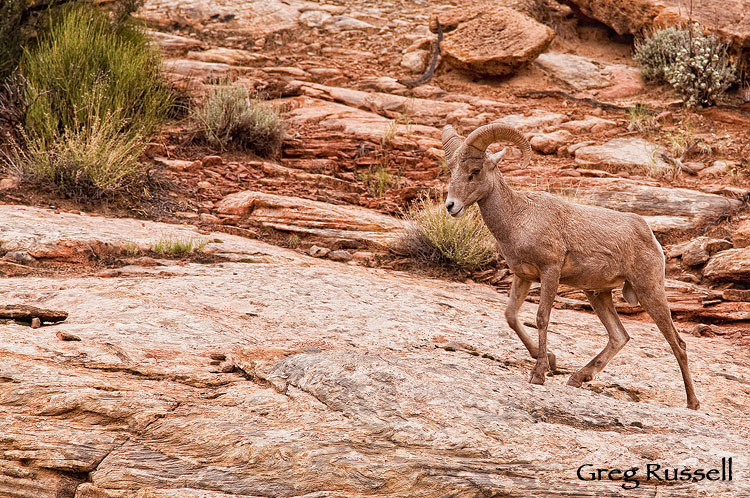
In the deserts and canyons of the southwest, water can be tough to come by; as a result, charismatic megafauna that rely on that water are often elusive and secretive.  The desert bighorn sheep (Ovis canadensis nelsoni) is a widespread, but uncommon resident of the southwest.

They truly are sentinels of the desert; on any given afternoon in Joshua Tree National Park,  you might see one surveying the landscape from atop a granite boulder.  In southwest Utah, they return to the canyons from the high country when the temperature starts to fall.  In the desert communities around Palm Springs, they illustrate the interaction between man and nature very well; bighorns have taken to eating ornamental cactus and other plants, so large fences have been erected to keep them out (which is ironic, because some people would pay to see a sheep!).

Desert Bighorn Sheep (Ovis canadensis nelsoni) in Joshua Tree
Desert Sentinel
Desert Bighorn Sheep (Ovis canadensis nelsoni), Capitol Reef National Park, Utah

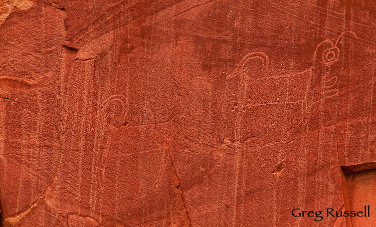
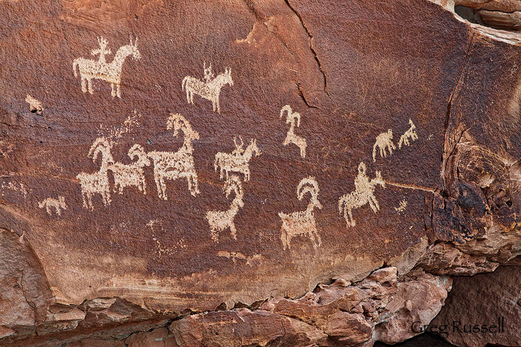
The interaction between humans and bighorns isn’t a recent thing, though.  In fact, humans have been interacting with them since the southwest was first settled, probably thousands of years ago.  If you take any interest in rock art at all, you’ll quickly find that bighorns were a ubiquitous subject of prehistoric artists.  Indeed, I wonder if the Ancestral Puebloan and Fremont peoples who lived with these animals found them just as captivating as we do today.

Fremont River petroglyphs, capitol reef national park, utah
Badly weather damaged petroglyphs depicting desert bighorn sheep
Wolfe Ranch Petroglyphs, Arches National Park, Utah

In some ways, the desert bighorn sheep embodies the spirit of the west: it is largely solitary, is resilient, and has shown a great ability to adapt to the desert environment.  Its a true steward of the ecosystems it thrives in.  The Desert Bighorn Council is a great resource to learn more about the biology and conservation of desert bighorn sheep (they list links to many local organizations as well).