california

...now browsing by category


Ghost Stories

Monday, August 23rd, 2010

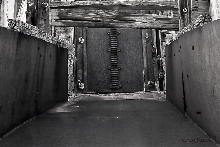
Sometimes you never know what to expect in the desert.  Death Valley National Park is home to hundreds (maybe thousands) of old mines, and on our last trip, we explored the remains of an old talc mine near Ibex Dunes–the Rainbow Talc Mine.  There were a lot of remnants strewn around the mine site (scrap metal, etc), and the shafts were really well preserved.  While not getting close to the edges, it was interesting to poke around and wonder what it was like to mine this area.

Remnants of a talc mine, Death Valley National Park, California

Remnants of the Rainbow Talc Mine, February 2010

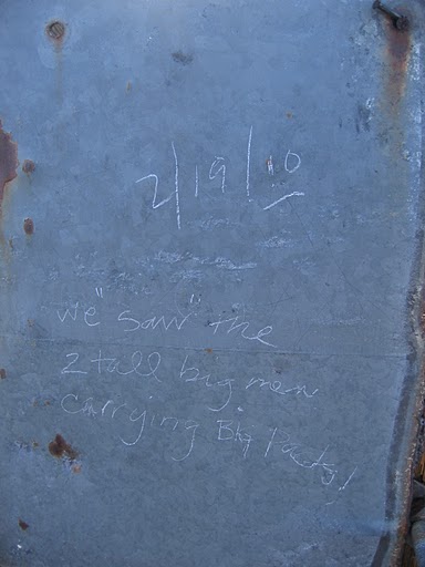
Upon leaving, my friend and I happened to notice a note scratched into a piece of scrap metal near the mine’s remains.  It said “We ‘saw’ the two big tall men carrying big packs! “ and was dated 2 days before our visit.  Could something have happened here that is causing the miners to linger, more than 30 years after its abandonment?

Note found at rainbow talc mine

Do you think we were being watched?

While I don’t believe in ghosts, I couldn’t help but look over my shoulder once or twice as we hiked out…just to make sure we weren’t being watched.

Have you ever had a spook while out on an adventure?  If so, please share it in the comments!

Stillness

Thursday, August 19th, 2010

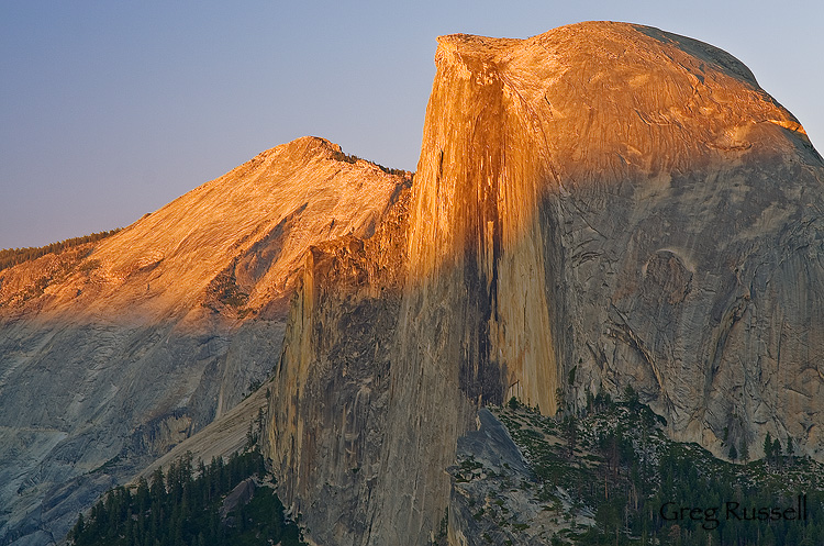
After leaving the Sierra high country, we hiked near the base of Half Dome (yes, we did climb it!), through Little Yosemite Valley, and eventually into Yosemite Valley itself.  While it was nice to have some of the luxuries of civilization (e.g. showers, flush toilets and beer), coming off the trail into that much chaos is a little overwhelming.   We spent the next day in the Valley picnicking, sight seeing and relaxing.  That night, we drove up to Glacier Point for one last look at the Yosemite high country, and to escape the crowds a bit.

On the way up to Glacier Point are some fantastic meadows that have gorgeous wildflowers, peaking in about mid-July.  Those meadows also have huge numbers of mosquitoes, so I didn’t spend long.

We spent most of our time enjoying the view from Glacier Point, reminiscing about the adventure we’d just had, and looking forward to the next one.  Not a bad end to a backpacking trip by any stretch of the imagination.

Half Dome, yosemite national park, california

Half Dome, July 2010

The Cathedral Range

Monday, August 16th, 2010

After reading Lyell Canyon, we hiked into Tuolumne Meadows–and civilization.  I have to admit that I feel like a bit of a prat “complaining” about re-entry into civilization after “only” 5 days in the backcountry, but I felt so relaxed and at ease from our adventures thus far, it was difficult to cope with suddenly being surrounded by cars, pets, and people…everywhere.  But, the cheeseburger I bought at the Meadow Grill was very welcome!

We had somewhat heavy rain all afternoon, and a fantastic sunset that night.  Unfortunately, I rode to Lee Vining with my wife and son to have dinner and help her get ready to join us on the trail the next morning.  She was more than a little excited for her first backpacking trip, and I couldn’t blame her.  How many people get to have their first backpacking experience among the most beautiful and awe-inspiring scenery in the world?

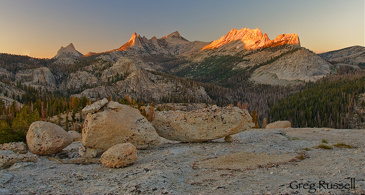
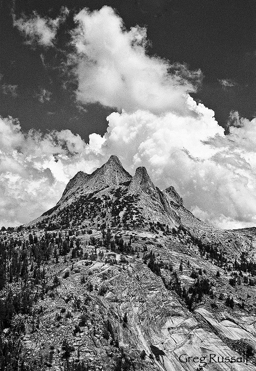
The following morning, with my friend and wife as company, we headed out towards Yosemite Valley, crossing over the Cathedral Range towards Sunrise High Sierra Camp (HSC).  The HSCs are fantastic camps with all the comforts at home.  We did our own cooking, but did enjoy not having to filter our water.  I also have to confess that I enjoyed the Minarets and the Ritter Range so much that I though the best scenery was behind us, but the views of the Echo Peaks, Mathes Crest, and Cathedral Range were among the finest of the entire trip.

That evening, I hiked up on top of a dome near Sunrise HSC to photograph these fantastic geological features.

Cathredral range at sunset

Cathedral Peak, the Echo Peaks, and Mathes Crest, July 2010

Echo Peaks, Yosemite National Park, California

The Echo Peaks, July 2010

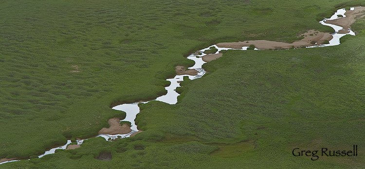
Stream in Yosemite National Park, California

Stream in Long Meadow, July 2010

It really was a fantastic evening, and was just a taste of what was to come.

Lyell Canyon

Thursday, August 12th, 2010

After leaving Thousand Island Lake, we continued north on the John Muir Trail, over Island Pass, and toward Donahue Pass.  The summit of Donahue Pass marked not only the entrance to a new watershed, but also the border between the Ansel Adams Wilderness (Inyo National Forest) and Yosemite National Park.

As expected, climbing 1300′ from Rush Creek to the summit of Donahue was not super enjoyable, and neither were the clouds of mosquitoes–probably the worst we’d encountered on our trip so far.  At one point, I set my pack down to have a snack, drink, and to rest my shoulders, and I counted about 40 mosquitoes on the shoulder straps!  However, bigger things were afoot today, as we watched the cumulus clouds condensing above us, and the thunderheads starting to build!  How exciting…perhaps my “curse” of photographing a cloudless Sierra would finally be broken.

By the time we arrived at the summit of Donahue Pass, the clouds were thick and thunder was rumbling all around us.  This is when my inner photographer began battling with my common sense.  The landscape on the Yosemite side of Donahue pass is among the most beautiful I’ve seen–fields of rich red Indian Paintbrush, gorgeous hanging valleys, a truly stunning alpine environment.  However, something inside tells me that its unwise to be above timberline when there is active lightning.  We chose to err on the side of survival and didn’t linger long for photos.

Despite my regrets about that, we did arrive in the bottom of Lyell Canyon with enough daylight to allow me to explore pretty extensively with my camera.  All of the side streams in the area (collectively known as the “Lyell Forks” of the Tuolumne River) and ever-present wildflowers, I had a fantastic time.  Plus, much to my pleasure, the mosquitoes were not bad–compared to the previous few days, I felt like they were nonexistent.  Yay!
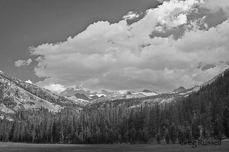
Lyell Canyon and Donahue Pass, Yosemite National Park

Lyell Canyon and Donahue Pass, July 2010
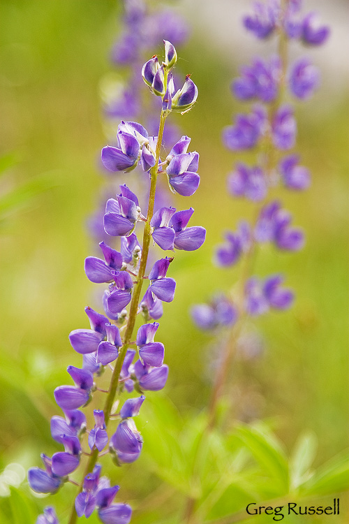
Lupine photo, Yosemite National Park

Lupine, July 2010

After dinner, I took another walk, heading back south, toward Donahue Pass.  My knees prevented me from hiking too far, but I did find some fantastic corn lilies (Clintonia borealis), which make fantastic abstract photos during the summer when they’re at their peak.
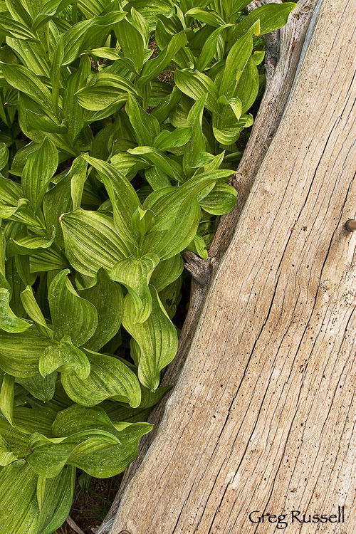
corn lilies and log, yosemite national park, california

Corn Lilies, July 2010

Finally, while walking back, I saw a fantastic sunset materializing through the trees.  While I didn’t have time to run back out to the open meadow, I did find an open area where I could use the river as a foreground element.  I can’t really complain at the way this image came out, making a fantastic ending to the day.
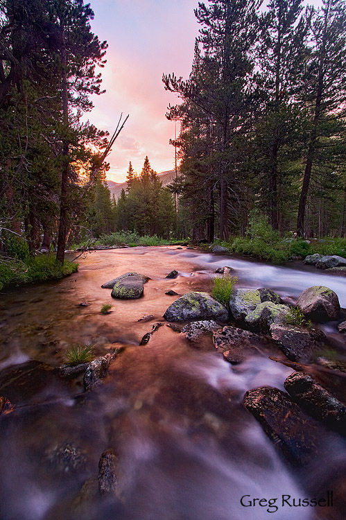
lyell forks of the tuolumne river, yosemite national park, california

Lyell Forks of the Tuolumne River, July 2010

As I laid in the tent that night, I looked forward to meeting my wife and son the next day in Tuolumne Meadows, and drifted off to sleep with visions of flush toilets, cold beer, and the Whoa Nellie Deli dancing through my head, not necessarily in that order.

To see all of my Yosemite images, click here.

Thousand Island Lake

Monday, August 9th, 2010

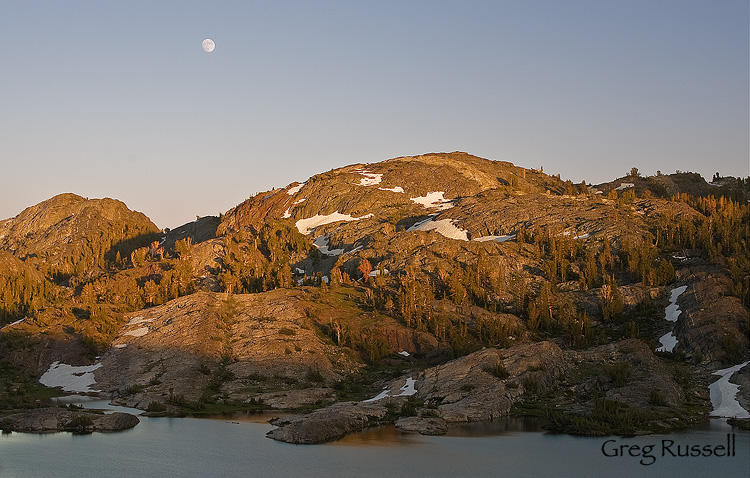
After leaving Garnet Lake, we hiked to Thousand Island Lake to spend the night.  While it was a busier place than we’d have hoped to settle down for the night (due to the convergence of the Pacific Crest and John Muir trails, as well as its proximity to Agnew Meadows for weekend backpackers), it surely is a gorgeous lake, and we were happy to camp on a little bench overlooking the water, giving us time to ponder whether there really are 1,000 islands.

Thousand Island Lake moonrise, Ansel Adams Wilderness

Moonrise, Thousand Island Lake, July 2010

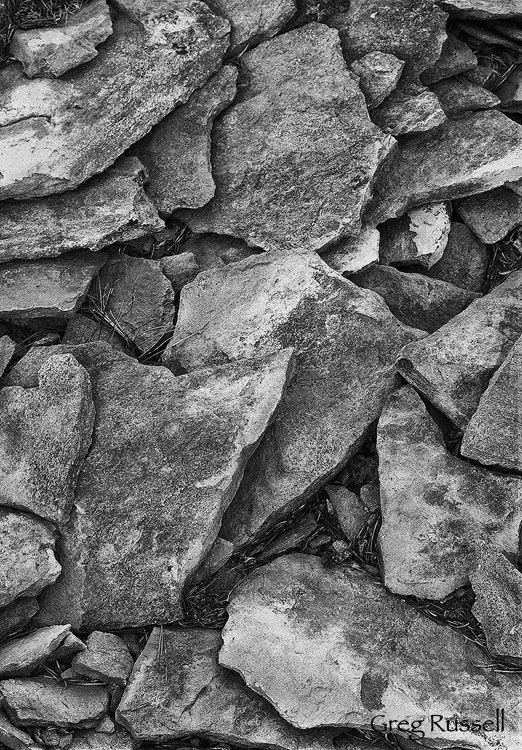
Since we were camped a little above 10,000′ elevation, we also encountered the first marmots of our trip.  As a side note, our trip thus far had been surprisingly sparse of any wildlife sightings, with very few if any mammals.  I spent some time in the evening trying to photograph a couple of marmots near our campsite to no avail, but I did enjoy some of the patterns present in the talus, and think they work really well as black and white images.

Talus near Thousand Island Lake, Ansel Adams Wilderness

Talus abstract, July 2010

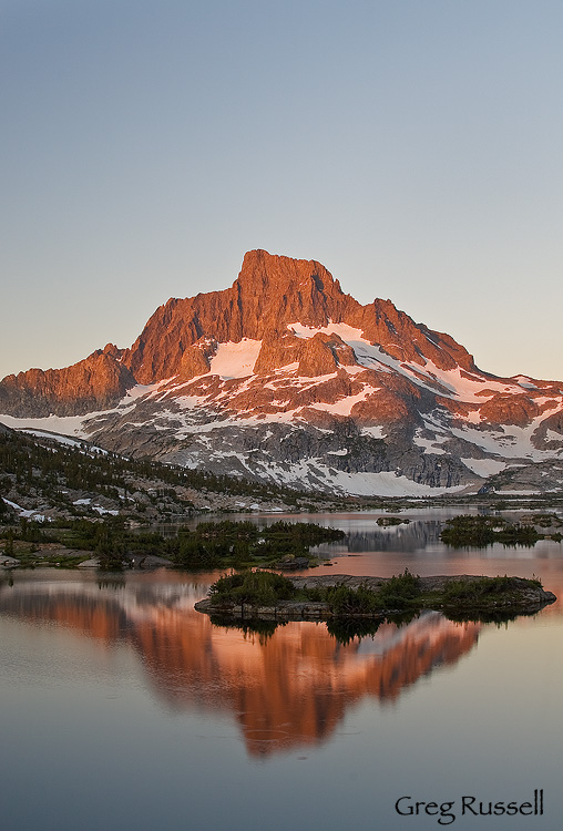
Of course, the big photographic attraction at Thousand Island Lake is a fantastic sunrise view of Banner Peak (Mt. Ritter is hidden behind Banner), and although this mountain has been photographed many times, I couldn’t resist getting up early the following morning to enjoy another fantastic sunrise in the Sierra Nevada.

Banner Peak, Ansel Adams Wilderness

Banner Peak at dawn, July 2010

After dawn, we ate breakfast and packed up, facing a long day.  This would be our final day in the Ansel Adams Wilderness; our plan was to cross over Donohue Pass and into Yosemite National Park.  More on that in my next post.  To see all of my Sierra Nevada Photos, click here.

Rosalie & Garnet Lakes

Friday, August 6th, 2010

After leaving our fantastic campsite on Minaret Lake, we rejoined the John Muir Trail and headed north.  For about six miles after the junction with the Minaret Lake trail, the JMT has to skirt a large volcanic ridge in order to get anywhere.  The trail isn’t difficult to follow, but it is all uphill, and its about 6 additional miles to a small, secluded lake–Rosalie Lake, where we decided to camp for the night.  This made for about a 12-mile day.  Unfortunately, the mosquitoes were much worse than we’d seen, and I’d even say they were maddening.  Of course, if there’s a mosquito within 100 miles, it’ll find me.  It just goes to show that a tent can not only be shelter, but sanctuary.

I got out the next morning to photograph sunrise on Rosalie, and got some nice images of the volcanic ridge we’d been hiking around lit up in the early morning light.

Rosalie Lake, Ansel Adams Wilderness

Rosalie Lake and Volcanic Ridge at dawn, July 2010

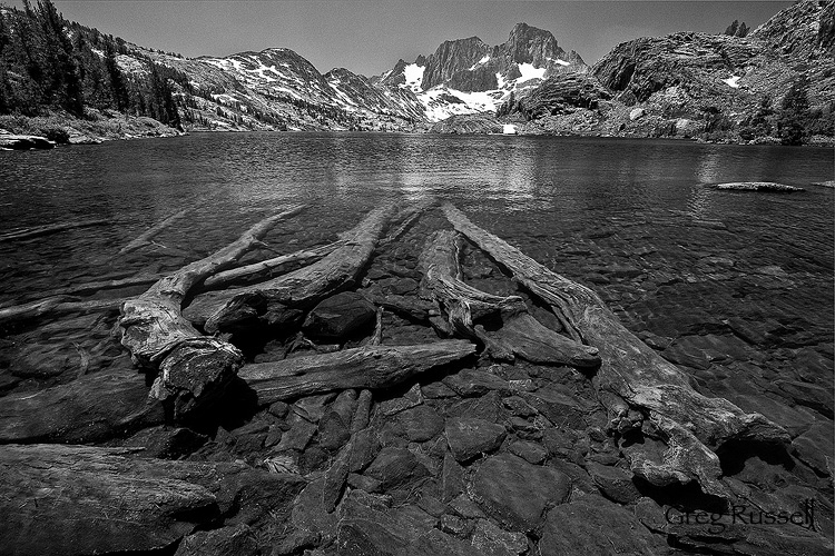
After eating breakfast and packing up, we headed down the trail to Shadow Lake, which is easily accessible as a day hike from Agnew Meadows.  We walked around Shadow Lake and headed on to Garnet Lake, which is a bit iconic, but still very pretty.  Garnet Lake offers fantastic views of  the northern Ritter Range, especially Mt. Ritter and Banner Peak.  I thought some submerged logs in Garnet would make a great foreground for this image.

Garnet lake and submerged logs, Ansel Adams Wilderness, California

Garnet Lake, July 2010

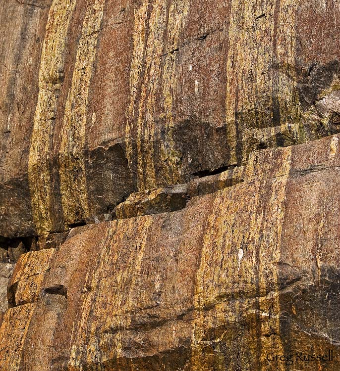
At Garnet Lake, I also found a great example of what can happen if you look underfoot.  The rocks here were fantastic, and had gorgeous bands of what I think is olivine (maybe serpentinite?) embedded in them.  I couldn’t help but photograph these rocks.  I used Tony Kuyper’s luminosity masks to really make the colors glow.

olivine

Garnet Lake Rocks, July 2010

We would continue on to Thousand Island Lake to spend the night.  That’ll be the subject of my next blog entry.  In the meantime, check out all of my Sierra Nevada photos by clicking here.

Off to the Sierra

Wednesday, July 21st, 2010

Today, we’re off to the Sierra Nevada for an 8-day backpacking/photography trip that will take us to the base of the Minarets, and along the John Muir trail to Yosemite Valley.  I’ll be posting journal entries as well as (hopefully) many new photos when we return at the end of July.  Be sure to check back for updates on the trip.

Its been 100+ at my home here in inland southern California for almost a week now; it will be nice to escape the heat in the high country.  I’m almost certain, however, that the mosquitoes will be numerous and large enough to pull me down the trail, if I can figure out a way to harness them.

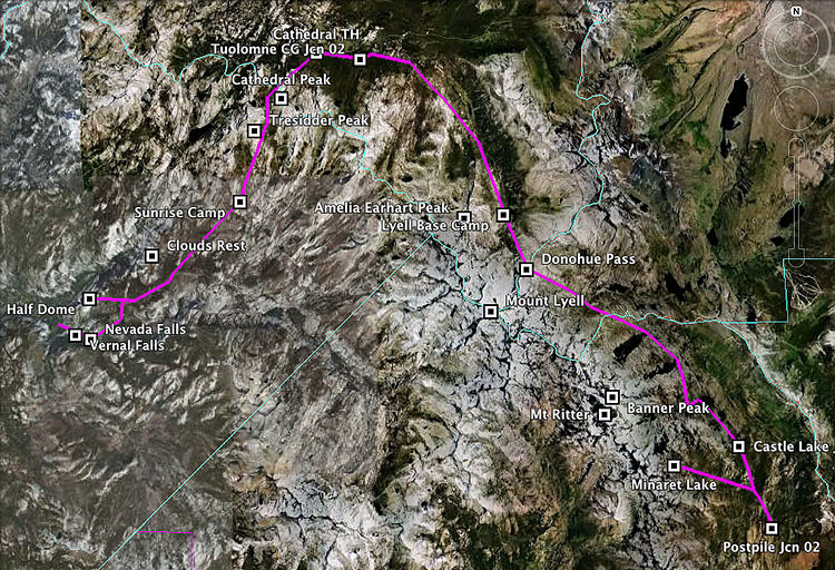
My hiking partner put together a GPS file of our route.  We’ll be starting at Devil’s Postpile, in the lower right, and ending at Happy Isles in Yosemite Valley.  You can click on the image to see a larger version.  Enjoy, have a great month, and see you when I return!

map of backpacking trip

Bleak

Monday, July 19th, 2010

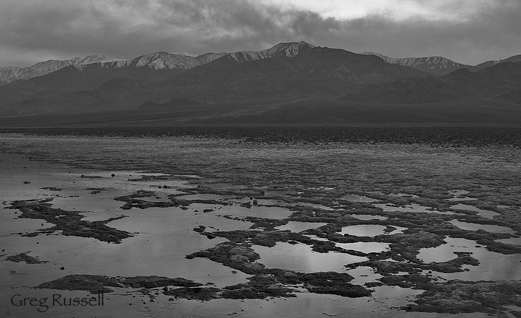
I’ve been playing around with some older RAW files lately, and remembered a series of shots from my February Death Valley trip.  When we arrived in the park, we immediately walked a short distance out into Badwater (Lake Manly when it has water in it), just to admire the scene.  Afterwards, we drove up the road, turned on to the West Side Road and were blown away by the amount of water present.  Overall, the light was drab, and I wasn’t too excited about the photos I was getting.

However, I’ve been able to resurrect some of these “blah” images as black and white photos–the clouds were present, the contrast and tonality was present, why not make a black and white image?  To that end, here are a couple of images.


Panamint Mountains, Late Afternoon, February 2010

storm in death valley national park, california

Stormy Skies, February 2010

The lesson here is simple: like these images AND in Death Valley, things may appear bleak on the surface, but if you’re willing to take the time and dig into them, you can find beauty just about anywhere.

To see all of my Death Valley images, click here.

Coloration in collared lizards

Friday, July 16th, 2010

Last week, I blogged about the huge variety of wildlife present in Joshua Tree National Park during the hot summer months.  Among my favorite animals in the park are the collared lizards, Crotaphytus bicinctores.  Collareds are aggressive, carnivorous lizards and are extremely flashy this time of of year.  They mate in late May-early July, and because of that, they have some fantastic colors.

male great basin collared lizard, joshua tree national Park california

Male Great Basin Collared Lizard, July 2010

The rich yellows and oranges on the legs, blue under the neck and black in the pelvic and pectoral areas are all characteristic of this species, and in my opinion, what makes it so beautiful.  The lizard above is a very accommodating male we found on the 49 Palms Oasis trail.  The females, however, are much less vibrant.

female great basin collared lizard, joshua tree national park california

Female Great Basin Collared Lizard, July 2010

Despite her more drab appearance, I still like the subtle hues present, especially the orange markings on the lateral sides of her body.  After the breeding season, these orange markings will fade, leaving the females a brownish color.  What do they mean?  While its long been known that animals change color, plumage, etc during their breeding season, a 2004 study published in the journal Herpetologica suggests that in female collared lizards, the orange markings signal to males that she is sexually receptive.  On average, orange female collared lizards were courted 5 times more frequently by males than non-orange females.

Its always important to remember that things that may just appear pretty (or sometimes, even ugly) to us very often have a function in nature.

Bighorn Sheep in Joshua Tree

Wednesday, July 14th, 2010

In my last post, I talked about some of the wildlife one can expect to find in the Mojave Desert on a hot summer day.  As it happens, that’s really only a small fraction of the diversity you’re bound to see.

After photographing birds, reptiles and insects, we headed over to my secret bighorn sheep location in hopes of finding at least one species of charismatic megafauna.  My spot did not disappoint: within about 20 minutes, I spotted a bighorn sheep ewe high on a rock, overlooking the landscape.

Desert bighorn sheep (ovis canadensis nelsoni) in joshua tree national park, california

The Sentinel, July 2010

The ewe let us walk closer to her, probably because (a) she had a good view of us, and (b) it was too hot for her to care.  Because of her cooperation, I was able to make closer images, especially using my friend’s 800mm lens.

Desert bighorn sheep (ovis canadensis nelsoni) in joshua tree national Park, california

Desert Bighorn Sheep, July 2010

After about 10 minutes, another sheep walked up to join the one we had been photographing.  I made a few more images, then left, so as to not stress them out too much–especially on a hot day!  To see all of my desert bighorn sheep images, click here.

Two desert bighorn sheep in joshua tree national park, california

The Sentinel's relief, July 2010