locations

...now browsing by category


Off to the Sierra

Wednesday, July 21st, 2010

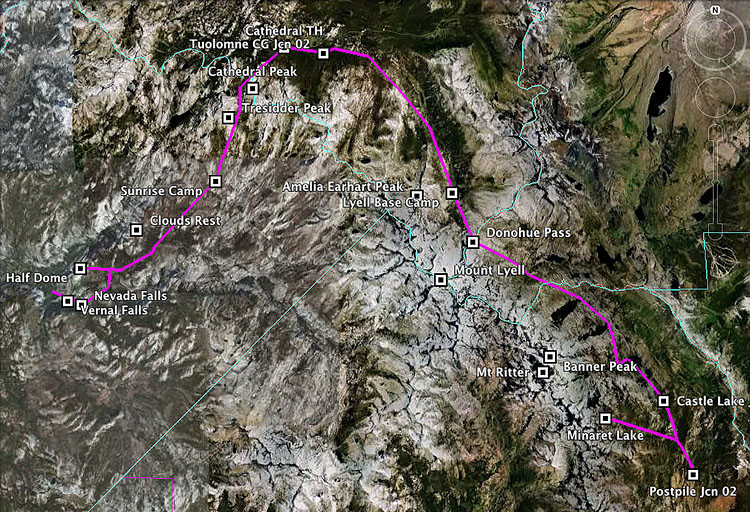
Today, we’re off to the Sierra Nevada for an 8-day backpacking/photography trip that will take us to the base of the Minarets, and along the John Muir trail to Yosemite Valley.  I’ll be posting journal entries as well as (hopefully) many new photos when we return at the end of July.  Be sure to check back for updates on the trip.

Its been 100+ at my home here in inland southern California for almost a week now; it will be nice to escape the heat in the high country.  I’m almost certain, however, that the mosquitoes will be numerous and large enough to pull me down the trail, if I can figure out a way to harness them.

My hiking partner put together a GPS file of our route.  We’ll be starting at Devil’s Postpile, in the lower right, and ending at Happy Isles in Yosemite Valley.  You can click on the image to see a larger version.  Enjoy, have a great month, and see you when I return!

map of backpacking trip

Coloration in collared lizards

Friday, July 16th, 2010

Last week, I blogged about the huge variety of wildlife present in Joshua Tree National Park during the hot summer months.  Among my favorite animals in the park are the collared lizards, Crotaphytus bicinctores.  Collareds are aggressive, carnivorous lizards and are extremely flashy this time of of year.  They mate in late May-early July, and because of that, they have some fantastic colors.

male great basin collared lizard, joshua tree national Park california

Male Great Basin Collared Lizard, July 2010

The rich yellows and oranges on the legs, blue under the neck and black in the pelvic and pectoral areas are all characteristic of this species, and in my opinion, what makes it so beautiful.  The lizard above is a very accommodating male we found on the 49 Palms Oasis trail.  The females, however, are much less vibrant.

female great basin collared lizard, joshua tree national park california

Female Great Basin Collared Lizard, July 2010

Despite her more drab appearance, I still like the subtle hues present, especially the orange markings on the lateral sides of her body.  After the breeding season, these orange markings will fade, leaving the females a brownish color.  What do they mean?  While its long been known that animals change color, plumage, etc during their breeding season, a 2004 study published in the journal Herpetologica suggests that in female collared lizards, the orange markings signal to males that she is sexually receptive.  On average, orange female collared lizards were courted 5 times more frequently by males than non-orange females.

Its always important to remember that things that may just appear pretty (or sometimes, even ugly) to us very often have a function in nature.

Wave Abstract

Tuesday, July 6th, 2010

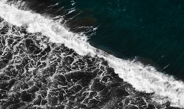
Lately, I’ve been using Nik Software’s plug-ins for Photoshop and have to admit that I’m loving them.  As a result, I’ve been revisiting some old images in an attempt to breathe some new life into them.  One image in particular that I’ve had in mind is this shot of the Pacific Ocean that I took in April on my visit to Anacapa Island in Channel Islands National Park.

waves in the pacific ocean, channel islands national park

Wave Abstract, April 2010

In this shot, I wanted to accentuate the detail in the waves, as well as the water texture in both the leading and tailing edges of the waves.  By processing the lower lefthand part of the image as monochrome using Nik Software’s Silver Efex Pro and leaving the upper righthand part of the image in color, I was able to accentuate the difference in these areas of the water.

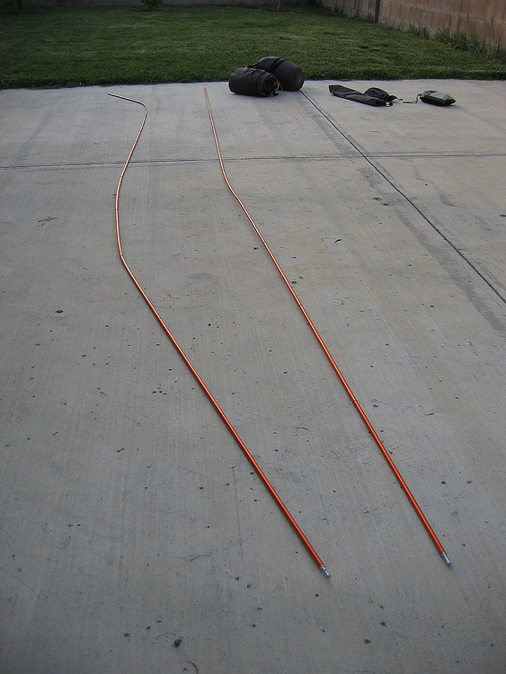
Incidentally, in my last post on my Channel Islands trip, I talked about how intense the wind was.  For most of the night, we dealt with wind gusts of 50-65 miles per hour, with no vegetative cover.  Equipment takes a beating in that kind of wind, and today I received an image from my friend, whose tent we used that night on Anacapa.  These tent poles used to be straight.

bent tent poles from anacapa island winds

The Wrath of Anacapa

Photo of the Month–July

Thursday, July 1st, 2010

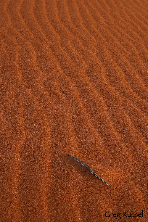
This month’s photo comes from Coral Pink Sand Dunes State Park, in southwestern Utah.  We visited the dunes in January; unlike other dunes I’ve visited, the sand here is full of iron oxides, giving it a brilliant red-pink color.  At sunset, the color gets even more brilliant.  The state park is an excellent place for camping and recreation, but the beauty of visiting in January is that you have the place to yourself.  Despite the brilliance of the entire dunes, I created this intimate landscape as the sun was going down, and its been one of my favorite photos of 2010 so far.

coral pink sand dunes state park, utah

Coral Pink Sand Dunes, January 2010

Hope you enjoy the photo!  To see all my shots from Coral Pink Sand Dunes, click here.

The Canyons of Utah, part 3

Monday, June 28th, 2010

In my last two blog posts (here and here), I described adventures down two technical slot canyons located in Zion National park in southwestern Utah.  Having been through these canyons before, without a camera, I knew it would be a crime to go through them again without a camera.  Because these canyons take 6-11 hours each without time for photography, I didn’t have a lot of time to stop for photos, but I’m glad I was able to bring some images home with me.

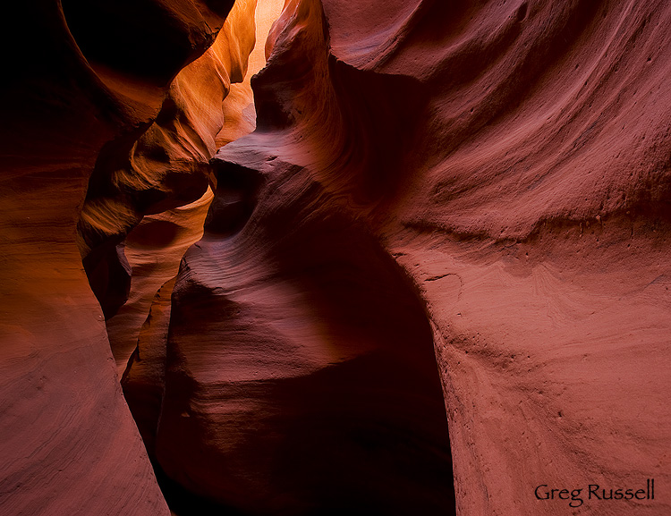
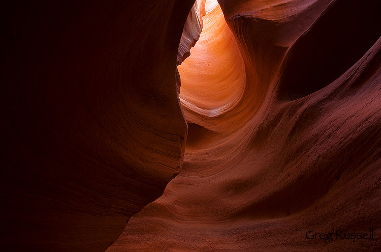
The final canyon I visited on my recent trip is located on BLM land outside of Zion National Park.  With the proper vehicle, this canyon could be driven to easily, but we had a very easy 1/2 mile walk to the mouth of the canyon.  Although the surrounding ecosystem is pinon-juniper woodland, this little gem is very reminiscent of Lower Antelope Canyon without the crowds (with the exception of one local family hoping to escape the heat, my dad and I had this canyon completely to ourselves).

Red Cave, a slot canyon located in SW Utah

Red Cave I, June 2010

Red Cave, a slot canyon located in SW Utah

Red Cave II, June 2010

After two days of rushing to find time for photography, it was very pleasant to be able to relax, slow down, and compose shots without worrying about holding my companions up.  All in all, though, it was a fine trip.  Indeed, if you let them, the chaos and beauty of the canyons will make you calmer, gentler, sweeter.  Here’s hoping you can find what relaxes you this summer.

To see all of my Red Cave shots, click here.

The Canyons of Utah, part 2

Friday, June 25th, 2010

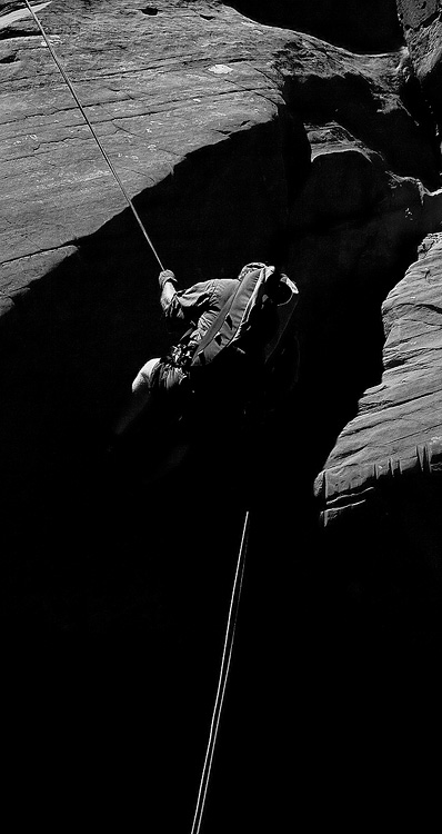
In my last post, I described Mystery Canyon, a slot canyon located in the backcountry of Zion National Park.  The day after visiting Mystery, we visited Behunin Canyon, another technical slots, and one of my favorite canyons in Zion.  You enter Behunin (named after Isaac Behunin, who had a homestead in Zion Canyon) from the West Rim Trail above Angel’s Landing, and the final rappel drops you into the Grotto, where you find the Emerald Pools.

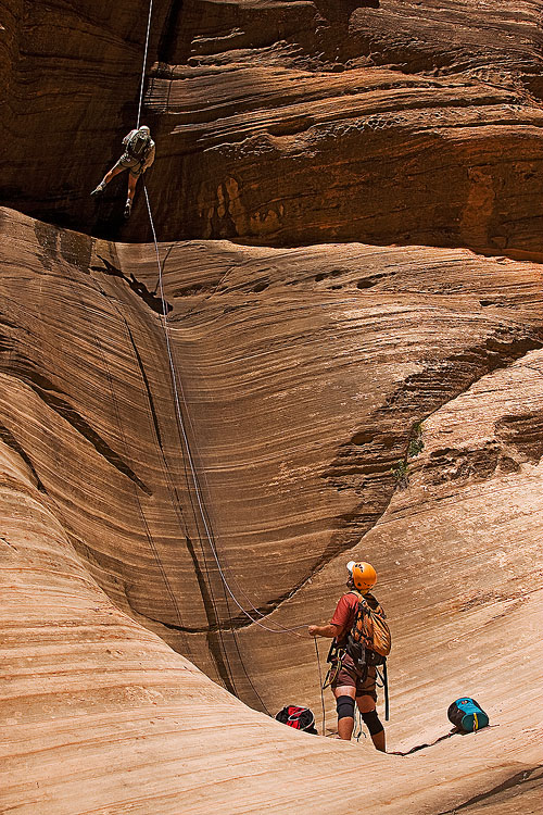
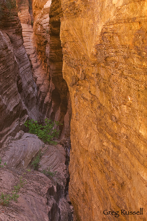
To me, the word “big” really describes Behunin.  All of the rappels are large–almost all are 100′ or longer–and you really feel like a small person in a large, amazing, beautiful place when you descend into this canyon.  This was my second time through this canyon, and I was able to enjoy the day much more with the added experience under my belt.

Canyoneers in Zion National Park, Utah

Rappelling in Behunin Canyon, Zion National Park, Utah

Inside a slot canyon

Deep inside Behunin Canyon, June 2010

One thing that canyons teach you about life is that change is a constant.  Last year when we descended into Behunin, it was almost completely dry.  This year, although we didn’t have any swims, we were definitely wading in water up to our knees most of the afternoon.  I suppose that adds a sense of adventure to the day when you don’t completely know what to expect.

A canyoneer rappels in Zion National Park, Utah

On rappel in Behunin Canyon, June 2010

I was happy to have my Dad join us for the Mystery Canyon descent, but back troubles prevented him from joining us in Behunin.  Maybe next year.  The day after Behunin, he and I visited one more slot canyon that I’ll talk about in my next post…

Off to Zion

Thursday, June 17th, 2010

Yesterday, I arrived in one of my favorite national parks: Zion.  Nothing screams summer to me quite like splashing through the pools and climbing on the sandstone in this wonderful national park.  I’m meeting some friends in hopes of descending a couple of technical slot canyons, and despite the ropes, harnesses and dry bags, I’m going to try to throw my SLR in as well.  I’m also hoping to take a day to hike up the Narrows of the Virgin River in hopes of getting some shots of the river, red rock walls, and green spring foliage.  However, that part of the plan may be cancelled…

Due to heavy snowfall in the high country all around the west this winter, all of our rivers and streams are flowing higher than normal; the Virgin River is no exception.  As of 6/9, the Virgin River in Zion is flowing at 190 cubic feet per second (cfs); the park service won’t even let people into the Narrows unless the flow is below 120 cfs.  However, the stream flow rate has been dropping steadily, and I’m confident I’ll be able to get into the Narrows.  Also, please don’t get me wrong; I’d much rather have to scrap a photo trip than have no water in the park.  The drought is far from over in the western US, but every little bit does help.

So, here’s to the Virgin River.  Have a fantastic weekend!

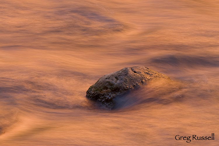
Virgin River abstract image, Zion National Park, Utah

Virgin River, Zion National Park, January 2010

To see all of my images from Zion National Park, click here.

San Juan Falls

Thursday, June 10th, 2010

Yesterday I went hiking near my home in the Santa Ana Mountains, which are a short, peninsular, mountain range found along the southern California coast.  I had a couple of hikes in mind, but on the urging of a friend, was excited to visit a local waterfall.

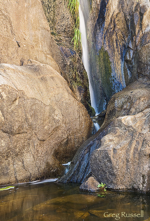
photo of san juan falls, santa ana mountains, california

Upper cascade of San Juan Falls, June 2010

San Juan Creek begins in the southern Santa Ana Mountains, a few miles northwest of Lake Elsinore. Its highest elevation is 5,100 feet (1,600 m) above sea level. Paralleling the Ortega Highway (California State Route 74) the creek flows erratically south, west and occasionally northwest. In the furthest upper reaches of the watershed, the creek is typically ephemeral. The creek channel in the uppermost few miles is a narrow mountain stream with many rapids and waterfalls, which include a series of large 5-to-15-foot cascades, known as San Juan Falls.

I was able to spend about 25 minutes with the falls before the sun peeked over the horizon, making photography difficult.  Hope you enjoy these photos!

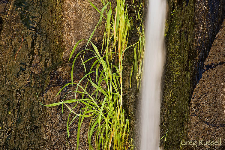
san juan falls, santa ana mountains, california

Upper cascade of San Juan Falls, June 2010

Whitney Crest panorama

Thursday, June 3rd, 2010

With our recent trip to the Sierra, I’ve been thinking of revisiting some photos that I’ve taken previously.  One that comes to mind is a panorama of Lone Pine Peak and Mt. Whitney (the ‘Whitney Crest’) from the Alabama Hills that I took last fall.  I shot this shortly after sunrise, and after shooting Mobius (Galen’s) Arch in the predawn light.  As one person noted, this is one of my favorite views.  Indeed.

Click on the photo to enjoy this image big.  It would, of course, look better hanging over your couch!

Panoramic photo of Mt. Whitney and Lone Pine Peak at sunrise

Whitney Crest at dawn, October 2009

Photographic notes: It is a panoramic image created from 5 horizontal frames.  I processed the RAW images twice, once for the highlights, and once for shadows, and blended the two resulting panos using luminosity masks.

Photo of the Month-June

Tuesday, June 1st, 2010

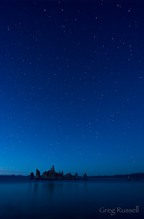
June’s photo of the month comes from one of my favorite summer places–Mono Lake.  Located at the base of the eastern Sierra Nevada mountains, Mono Lake is one of the few remnants of Ice Age lakes in the West that is still a year-round lake. The lake has persisted for more than 730,000 years, but faces an uncertain future from both natural and man-made causes. The lake is very alkaline and since 1941, has become moreso, due to the diversion of freshwater springs into the Los Angeles aqueduct. By 1982, the lake’s level had dropped 45 feet, exposing something that makes Mono unique: curious brown structures called tufa towers. Tufa towers are deposits of calcium carbonate (due to calcium present in underwater freshwater springs, and carbonate in the lake water).

Over Memorial Day weekend, we visited the eastern Sierra on a family camping trip, and I was able to sneak out to make this image Sunday night.  I haven’t done many star field shots, but this one really captures the essence of the lake for me.  A few months ago, I blogged on just how popular the lake has become with photographers.  True to form, when I arrived to set up this shot on Sunday night, there were at least 40 photographers present at South Tufa, and I got some funny looks as I started setting up while everyone else was leaving.  Soon, I had the entire place to myself, and I could contemplate the cosmos while darkness overtook the landscape.

This is one of my favorite images from the night.

Mono Lake California under a starry night time sky

The Ghost Ship, Mono Lake, May 2010

Click here to see more of my Mono Lake photos.