locations

...now browsing by category


Wind Song

Monday, May 30th, 2011

If you have never listened to the wind, you should.  It can really have a lot to say.  This last week, it screamed, violently, through the midwestern United States, leaving a terrible path of destruction in its wake.

Some areas are known for their wind.  Medicine Bow, Wyoming (home of the Virginian Hotel, made famous by Owen Wister), for instance is one of the windiest places in the United States.  When I lived in Wyoming, a rancher once told me that the wind doesn’t blow 24 hours out of the whole year in Medicine Bow.  I’m not sure how true that is, but I do know that a still day is difficult to come across.  The wind’s constant howling through the rafters and windows of homes has driven people mad in Wyoming.  Although it can’t be stopped, it can be used.  Wind farms are becoming more and more common in the windy areas of the West as an alternative to coal-powered energy.

However, just as easily as it can destroy, wind can also be gentle, almost loving.  The wind is a vital component of the weather, moving storms the feed plants and animals alike.  The wind is a pollinator, and in polluted areas, it helps to clear the air.

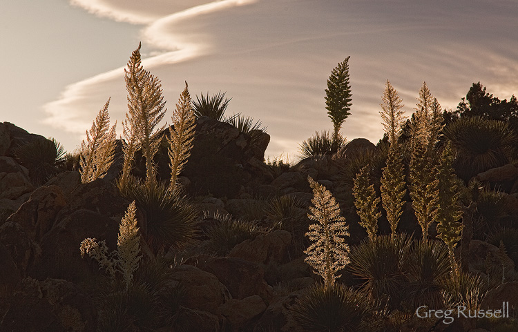
Recently, on a quick trip out to Joshua Tree National Park,  the wind blew all afternoon, and it must have been really blowing in the upper atmosphere, because a breath-taking lenticular cloud formed over the park.  It dissipated before sunset, but these Parry’s Nolina (Nolina parryi) almost looked like they were dancing, sexily swaying their hips, in the late afternoon light.  You can see the tail end of the lenticular in the sky.


Parry's Nolina, Joshua Tree National Park
Wind Song, May 2011

The wind is definitely talking.  What do you hear?

In Memoriam

Monday, May 16th, 2011

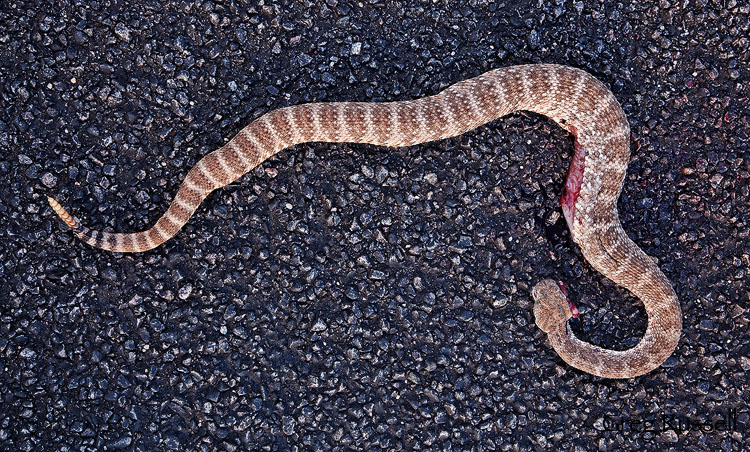
This weekend, a friend and I made a last minute trip out to Joshua Tree National Park to search for photography opportunities.  After doing a short hike, we drove into the main park entrance about 5:30pm.  Although the temperature was starting to drop, the asphalt was still warm; it didn’t take long before we discovered this freshly road killed Speckled Rattlesnake (Crotalus mitchllii pyrrhus).  Its a species I’ve always wanted to photograph–just not like this.

Speckled Rattlesnake in Joshua Tree National Park, California

In Memoriam, May 2011

Its always somber to see road killed reptiles, but this was just the beginning.  Not five minutes later, we pulled a very badly injured (fatally, I’m sure) coachwhip (Masticophis flagellum) off the road, and over the course of the evening, we found a gopher snake (Pituophis catenifer), and a red diamond rattlesnake (Crotalus ruber) that had been killed earlier in the day.  It was carnage–easy to see why–with cars whizzing by us at 50-60 mph (25-35 mph over the posted speed limit).

Accidents happen, especially with fast-moving snakes like gopher snakes or coachwhips–they can jump out in front of a driver, with no hope of being avoided.  But, as my friend pointed out, there is no excuse for killing a rattlesnake in a park where the speed limit is 25 or 35 miles per hour.  They’re visible animals, and when following the speed limit, they can be avoided, largely because they are slow-moving.

April and May is peak camping season in Joshua Tree–the campgrounds are full, and people are everywhere.  Right now, that time of day is suicide for a basking snake.

To make it worse, the red diamond rattlesnake we found later in the evening was missing its rattle.  I hate to think about someone hitting the animal purposely to take the rattle (although I know of people who have done just that)–its a despicable act.  Even if a later driver stopped to take it, I wouldn’t want to be that person if a park ranger came down the road!

I know I sound like a real square with this post, urging people to stick to the posted speed limit, but after what we witnessed this weekend in Joshua Tree, its obvious that slowing down could really help to save some beautiful wildlife from needless deaths.

Just Like Everywhere…and Nowhere

Tuesday, May 10th, 2011

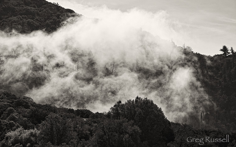
Despite my love for the high desert, I have to confess that it feels pretty good to be back in the mountains for the summer.  This weekend, we headed to the San Bernardino mountains for a quick, local, Mother’s Day camping trip.  On the way home, fog from a very heavy marine layer was working its way inland, and up into the foothills of the mountains.  I loved the way it was drifting through the valleys, and watching it move slowly gave a lovely sense of peace.

Click on the image to view it large on black (highly recommended)

Fog drifts in the valleys of the San Bernardino Mountains above Redlands

In the Clouds, May 2011

One of the things that gives this image its uniqueness is the skeletons of dead pine trees scattered throughout the hillside; however, its also those trees that make this a not-so-uncommon scene in the West.  The trees were killed by mountain pine beetles, which have not only devastated forests in southern California, but all over the West.  They burrow into the trees, and block their ability to assimilate nutrients.  Its interesting to me how the appeal of an image can be imparted from the biology that killed the trees.

This scene is also is a reminder of the nature of landscape photography in general.  Although you might see other scenes similar to this, no one will ever be able to make this same image again.  As I made this image, I thought to myself about coming back on a day with similar weather, when I have more time to try making images.  I probably will return at some point, but this was really serendipitous weather.  Running into (or in my case, haphazardly stumbling upon) an ephemeral scene like this, and being able to make an image of it, is really the essence of the craft.

I hope you had a fantastic Mother’s Day!


Photo of the Month–May

Sunday, May 1st, 2011

Its true what they say: sometimes the unexpected surprises are the best.  Although I live a few miles from the Santa Ana Mountains, I haven’t explored them nearly enough.  The Santa Anas are one of the peninsular mountain ranges in southern California, and while they are a coastal range, they are far enough inland to get quite dry and hot during the summer months.

One of the things I love about this range is all of the waterfalls and cascades.  Not nearly on par with anything you might find in Yosemite, these little rivulets are quite charming, and each is a little bit different.  Last year, I spent some time with San Juan Falls, one of the easier falls to access.  This past week, Marc Perkins and I headed back to the Santa Anas to look for another waterfall.

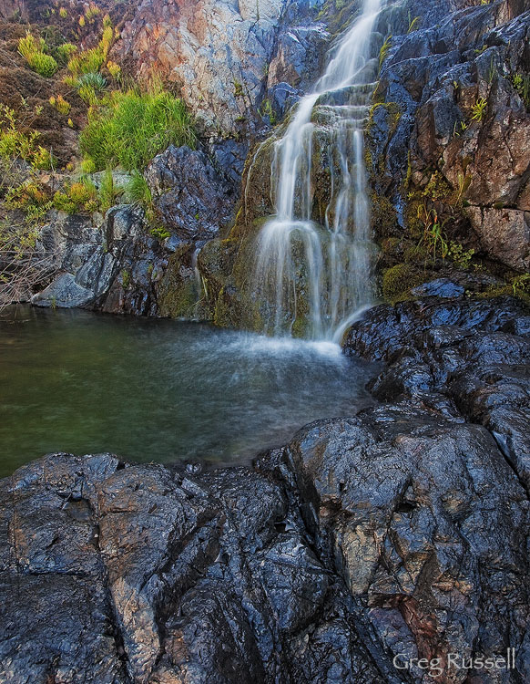
Upper Hot Springs is another small stream, and the falls cascade about 30 feet over some very colorful rocks.  Last year, I attempted to hike to this area, but was turned around because of dense poison oak.  Last week, the trail was much more easy to find, and we found the falls with no problems.  In contrast to the oak and sycamore environment of the stream bed, the area around the falls was covered in succulent plants (whose name I do not know).

The falls on Upper Hot Springs Creek, Santa Ana Mountains, California

Upper Hot Springs

As far as I could tell, the falls don’t live up to their name in that the water wasn’t especially hot.  Oh well.  It wasn’t the best day for a soak in hot springs anyway!

I hope you enjoy the image; you can see the rest of my images from the Santa Ana Mountains here.


Shelter from the Storm

Thursday, April 21st, 2011

All rocks are not created equally; not only do they vary in surface characteristics like color and shape, they also vary in properties that aren’t immediately visible.  Rocks erode at different rates, and the elements that make them up oxidize differently, giving rock formations different colors as time passes.  These characteristics are what gives the Colorado Plateau its uniqueness–there really is no other biome on earth quite like it.

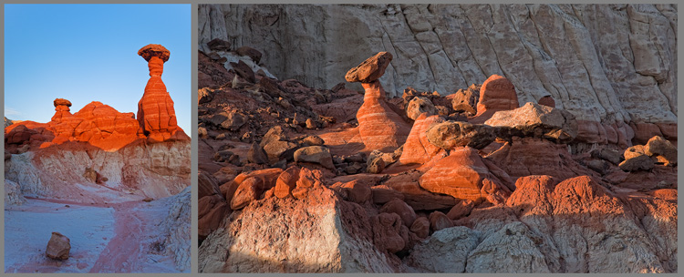
Any visitor to the southwest should become quickly acquainted with hoodoos–rock spires usually found protruding from a drainage or badlands.  Hoodoos are typically formed when a rock or boulder from a newer (therefore stratagraphically higher) layer of sandstone falls onto an older layer.  The boulder erodes more slowly, but it also protects the rock underneath it from eroding, leaving the characteristic spire with the cap rock on top of it–in this way the cap rock almost shelters the underlying rock from erosion.

On my recent trip to Utah, I made a couple of sunset visits to the Toadstool Hoodoos, located in the extreme southern end of the Grand Staircase-Escalante National Monument.   Like other hoodoos, the Toadstools were formed when boulders from the Dakota Formation fell onto the older rock of the Entrada Formation.  Dakota Sandstone erodes more slowly, leaving vibrantly colored hoodoos in a stunning badlands setting.

(Click on the diptych to view it large.)

Toadstool Hoodoo, Grand Staircase-Escalante National Monument

Toadstools , March 2011

A large part of the draw of the Colorado Plateau is the interesting geology.  For me, its one thing to marvel over a beautiful formation; its another, more fulfilling, thing to marvel over how it formed.

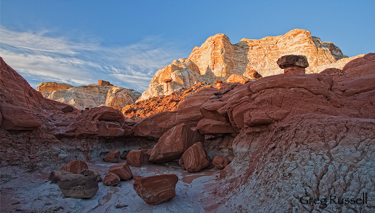
Rimrock Badlands, Grand Staircase-Escalante National Monument

Hoodoo Garden, March 2011

The Paria, part III: mud

Friday, April 15th, 2011

In addition to its immense, subtle beauty, another overriding theme of the Paria River is mud.  The river bed has a high clay content, and if you’ve ever been in clay soil when its even a little wet, you know it can be a disaster–its slick, sticky, and vehicles can get stuck in it in a moment.

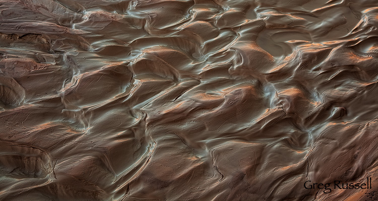
In the spring, runoff from high elevation prevents some mud (by way of keeping from drying enough to reach that sticky, goopy, phase), but its always a factor.  What I like about clay is that it always forms beautiful patterns as it begins drying out.  This little patch was reflecting the red rock cliffs on the opposite side of the river early in the day.

Beautiful mud formations on the Paria River, Utah

Mud & Reflections, March 2011

I also ended up finding a few areas of quicksand, involuntarily, on my hike in the Paria.  I felt the area with my hiking pole, and feeling solid, I stepped, only to be swallowed up to my thigh almost instantly.  Fortunately, it was easy to pull myself out.  People who haven’t dealt with it have a misconception about quicksand.  It can’t really suck you into oblivion like childhood cartoons and TV shows lead you to believe.  But, as Ed Abbey writes,

Ordinarily it is possible for a man to walk across quicksand, if he keeps moving. But if he stops, funny things begin to happen. The surface of the quicksand, which may look as firm as the wet sand on an ocean beach, begins to liquefy beneath his feet. He finds himself sinking slowly into a jelly-like substance, soft and quivering, which clasps itself around his ankles with the suction power of any vicsous fluid. Pulling out one foot, the other foot necessarily goes down deeper, and if a man waits too long, or cannot reach something solid beyond the quicksand, he may soon find himself trapped. … Unless a man is extremely talented, he cannot work himself [into the quicksand] more than waist-deep. The quicksand will not pull him down. But it will not let him go either. Therefore the conclusion is that while quicksand cannot drown its captive, it could possibly starve him to death. Whatever finally happens, the immediate effects are always interesting.

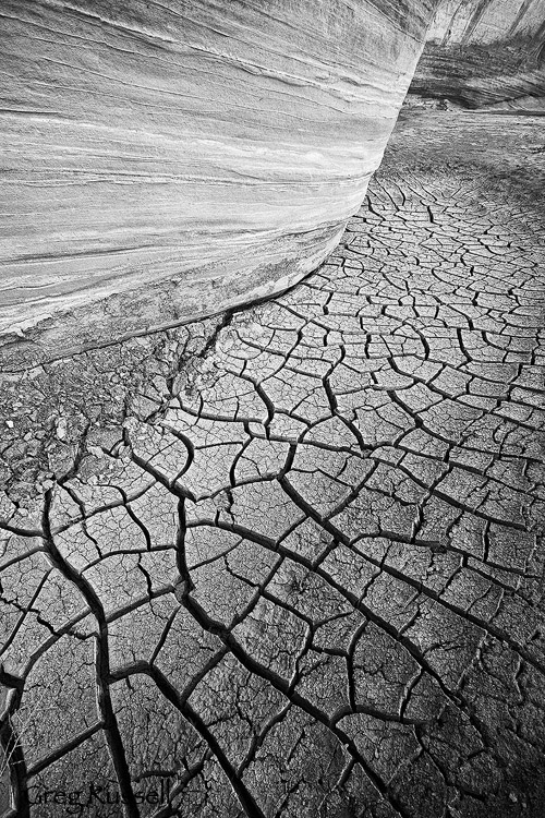
Finally, the most beautiful effects, in my opinion, happen when the mud begins drying.  Because clay expands so much when wet, it cracks in beautiful, wonderfully stochastic patterns.  You can find little pockets of dried mud all along the bases of the sandstone walls.

Cracked Mud, Paria River, Utah

Sandstone and Mud, March 2011

Mud is a major component of the landscape in the Paria, as well as throughout any ephemeral drainage in the southwest.  While it can be viewed as a nonphotogenic nuisance, sometimes, its helpful to look at it in a new light.

The Paria, part II: immensity

Tuesday, April 12th, 2011

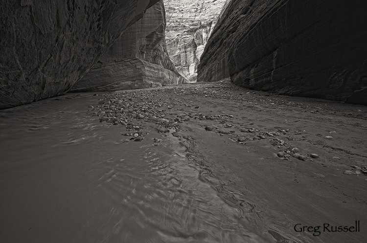
In my last post, I talked about the subtle beauty along the Paria River in southern Utah.  It doesn’t take one long to realize just how big this place is too.  You begin hiking in the river bed, but at this point the canyon is broad, maybe half a mile across.  However, as you hike downstream, the walls narrow and swell upward, leaving you in a canyon of literally inescapable beauty.

Near the confluence of the Paria River and Buckskin Gulch, you reach Sliderock Arch.

Sliderock arch, Paria River, utah

Sliderock Arch I, March 2011

Sliderock is hardly an arch in the way we normally think about an arch.  Rather than being eroded by wind and water, Sliderock Arch was formed when a large piece of sandstone fell from the wall above, hit the river bed, and leaned up against the wall.  Let me give you a sense of scale.  The opening of the arch, on the left, is about 20′ × 20′.  The righthand “arm” of the arch is about 40′ wide.  This is one big piece of rock.

Although the Paria Narrows may not be as narrow as other canyons in the southwest, they rival any canyon in immensity.


The Paria, part I: subtlety

Friday, April 8th, 2011

In the spirit of David Hyde’s travelogues (read the most recent here), I’ll present my recent trip to southern Utah in three parts.  However, rather than document the trip, I’ll write about three themes that came to mind as I hiked, and photographed.

Although I visited other locations (like Valley of Fire State Park), the primary purpose of my recent trip was to hike a portion of the Paria River, between the White House trailhead, and its confluence with Buckskin Gulch.  I think the Paria was one of those rivers I was meant to spend time with at some point in my life.  As a teenager, I remember reading about some of the “classic” rivers of the southwest: the Dirty Devil, the Escalante, and–of course–the Paria.  Unlike most of my peers at the time, I found a certain draw in that lovely, beautiful, muddy water.  The hike all the way to Lee’s Ferry, Arizona is considered to be one of the finest backpacking trips in the region.

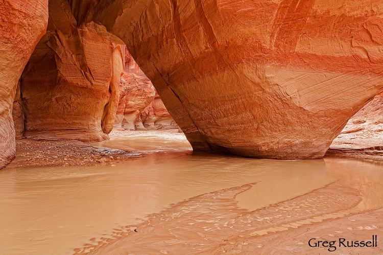
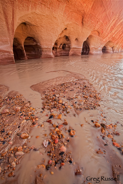
Last week, I spent a day in the canyon, which starts out broadly, and narrows down after about 4 miles.  One thing I immediately noticed about the Paria is that its gorgeous–beautiful–but that beauty isn’t as in-your-face as other locations in the Southwest, like Zion, or the Wave.  This subtle beauty becomes apparent as you sit watching sandstone walls and erosions as the light passes, playing on it.  Or, as you contemplate the effects of thousands of years of wind and water on the stone.

The Windows on the Paria River, Utah
Windows into the past, March 2011

Once you enter the Paria narrows, the canyon turns from a broad, meandering line to a series of twists and turns.  However, the overhanging sandstone walls to give occasional views of the “outside.”  Again, subtle beauty is key.

The Paria River, in southern Utah
Subtle Beauty, March 2011

Grand, subtle, nuances prevail in the Paria River canyon.  What areas do you find these qualities in?

Photo of the Month–April

Friday, April 1st, 2011

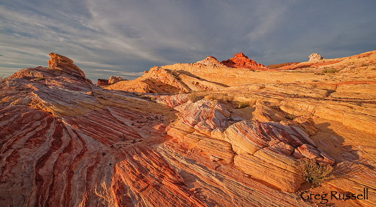
Sometimes choosing an image of the month is really easy, but this month its rather difficult.  I just returned from a fantastic trip to southern Utah and Valley of Fire State Park in Nevada.  Of course I wanted to capture some new images, but it was a time to clear my head, shake some of winter’s cobwebs out of my skull, stretch, and welcome spring on the Colorado Plateau.

The added bonus of revisiting some favorite locations in Utah was discovering someplace new and wonderful.  Among landscape photographers, Valley of Fire State Park, near Las Vegas, has been getting a lot of buzz lately, and for good reason.  To say this place is amazing is an understatement.  If you love colorful vistas, sandstone, and interesting geology, you need to pack your bags and go now.  It really is that spectacular.  And, there are a lot of unexplored areas waiting to be discovered.

I don’t have a Valley of Fire page set up yet, but I’ll be sharing some new images over the next few days, and will tell you when you can view the gallery.  Until then, I hope you enjoy this lovely sunset.

Dramatic sunset at Valley of Fire State Park, Nevada

Candy Land Sunset, March 2011

Mecca Hills Wilderness

Monday, March 28th, 2011

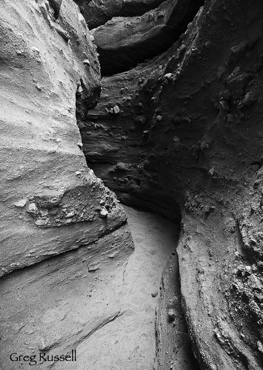
Late last week, we made a day trip out to the Mecca Hills Wilderness, which is located near Indio California in the Coachella Valley.  The landscape twists and turns in a very unique and beautiful way; formed by the San Andreas fault, the Mecca Hills are a badlands with colors reminiscent of the Artists’ Palette in Death Valley National Park, and canyons that would rival even the narrowest of slot canyons in Utah.

While there, we made sure to stop and hike through the popular Ladder Canyon.  Only 3-4′ wide in places and over 200′ deep, Ladder Canyon would be a technical ascent (or descent) if it weren’t for the ladders which give the canyon its name.  Due to the hike’s popularity and proximity to Palm Springs, solitude came in sporadic bursts.  Still, it was great to be in there, making images.

Ladder Canyon, Mecca Hills Wilderness, California
Ladder Canyon, March 2011

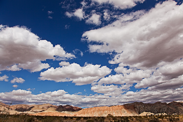
A series of unusually strong late-season storms have been hitting southern California for the last week or so, too.  Driving out, the fast-moving clouds from one of the systems had an interesting play on the light over the badlands.

Mecca Hills Wilderness Badlands, California

Badlands & Clouds, March 2011

I’m unplugging and heading off to Utah and Nevada for the week.  Hope you have a good one!