utah

...now browsing by category


The Paria, part III: mud

Friday, April 15th, 2011

In addition to its immense, subtle beauty, another overriding theme of the Paria River is mud.  The river bed has a high clay content, and if you’ve ever been in clay soil when its even a little wet, you know it can be a disaster–its slick, sticky, and vehicles can get stuck in it in a moment.

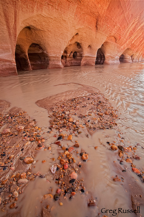
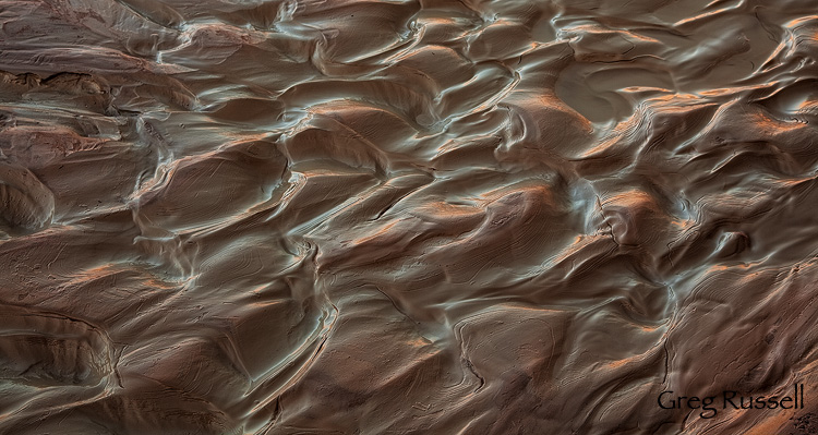
In the spring, runoff from high elevation prevents some mud (by way of keeping from drying enough to reach that sticky, goopy, phase), but its always a factor.  What I like about clay is that it always forms beautiful patterns as it begins drying out.  This little patch was reflecting the red rock cliffs on the opposite side of the river early in the day.

Beautiful mud formations on the Paria River, Utah

Mud & Reflections, March 2011

I also ended up finding a few areas of quicksand, involuntarily, on my hike in the Paria.  I felt the area with my hiking pole, and feeling solid, I stepped, only to be swallowed up to my thigh almost instantly.  Fortunately, it was easy to pull myself out.  People who haven’t dealt with it have a misconception about quicksand.  It can’t really suck you into oblivion like childhood cartoons and TV shows lead you to believe.  But, as Ed Abbey writes,

Ordinarily it is possible for a man to walk across quicksand, if he keeps moving. But if he stops, funny things begin to happen. The surface of the quicksand, which may look as firm as the wet sand on an ocean beach, begins to liquefy beneath his feet. He finds himself sinking slowly into a jelly-like substance, soft and quivering, which clasps itself around his ankles with the suction power of any vicsous fluid. Pulling out one foot, the other foot necessarily goes down deeper, and if a man waits too long, or cannot reach something solid beyond the quicksand, he may soon find himself trapped. … Unless a man is extremely talented, he cannot work himself [into the quicksand] more than waist-deep. The quicksand will not pull him down. But it will not let him go either. Therefore the conclusion is that while quicksand cannot drown its captive, it could possibly starve him to death. Whatever finally happens, the immediate effects are always interesting.

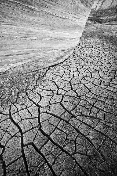
Finally, the most beautiful effects, in my opinion, happen when the mud begins drying.  Because clay expands so much when wet, it cracks in beautiful, wonderfully stochastic patterns.  You can find little pockets of dried mud all along the bases of the sandstone walls.

Cracked Mud, Paria River, Utah

Sandstone and Mud, March 2011

Mud is a major component of the landscape in the Paria, as well as throughout any ephemeral drainage in the southwest.  While it can be viewed as a nonphotogenic nuisance, sometimes, its helpful to look at it in a new light.

The Paria, part II: immensity

Tuesday, April 12th, 2011

In my last post, I talked about the subtle beauty along the Paria River in southern Utah.  It doesn’t take one long to realize just how big this place is too.  You begin hiking in the river bed, but at this point the canyon is broad, maybe half a mile across.  However, as you hike downstream, the walls narrow and swell upward, leaving you in a canyon of literally inescapable beauty.

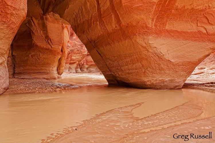
Near the confluence of the Paria River and Buckskin Gulch, you reach Sliderock Arch.

Sliderock arch, Paria River, utah

Sliderock Arch I, March 2011

Sliderock is hardly an arch in the way we normally think about an arch.  Rather than being eroded by wind and water, Sliderock Arch was formed when a large piece of sandstone fell from the wall above, hit the river bed, and leaned up against the wall.  Let me give you a sense of scale.  The opening of the arch, on the left, is about 20′ × 20′.  The righthand “arm” of the arch is about 40′ wide.  This is one big piece of rock.

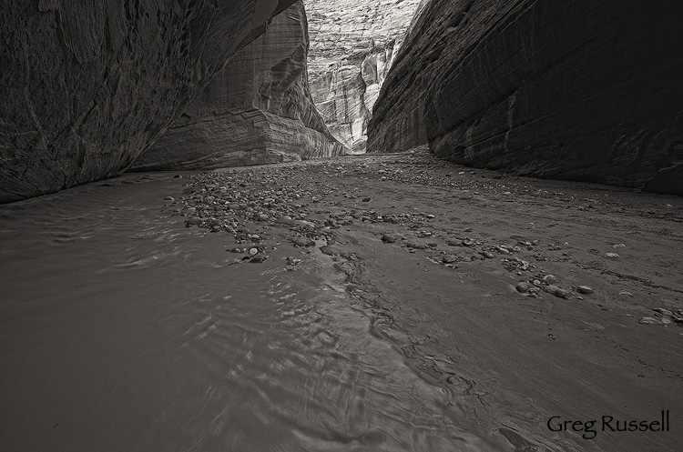
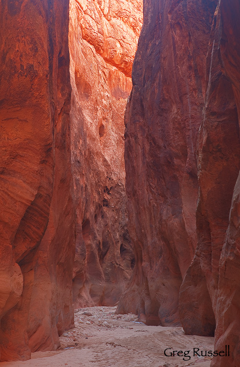
Although the Paria Narrows may not be as narrow as other canyons in the southwest, they rival any canyon in immensity.


The Paria, part I: subtlety

Friday, April 8th, 2011

In the spirit of David Hyde’s travelogues (read the most recent here), I’ll present my recent trip to southern Utah in three parts.  However, rather than document the trip, I’ll write about three themes that came to mind as I hiked, and photographed.

Although I visited other locations (like Valley of Fire State Park), the primary purpose of my recent trip was to hike a portion of the Paria River, between the White House trailhead, and its confluence with Buckskin Gulch.  I think the Paria was one of those rivers I was meant to spend time with at some point in my life.  As a teenager, I remember reading about some of the “classic” rivers of the southwest: the Dirty Devil, the Escalante, and–of course–the Paria.  Unlike most of my peers at the time, I found a certain draw in that lovely, beautiful, muddy water.  The hike all the way to Lee’s Ferry, Arizona is considered to be one of the finest backpacking trips in the region.

Last week, I spent a day in the canyon, which starts out broadly, and narrows down after about 4 miles.  One thing I immediately noticed about the Paria is that its gorgeous–beautiful–but that beauty isn’t as in-your-face as other locations in the Southwest, like Zion, or the Wave.  This subtle beauty becomes apparent as you sit watching sandstone walls and erosions as the light passes, playing on it.  Or, as you contemplate the effects of thousands of years of wind and water on the stone.

The Windows on the Paria River, Utah
Windows into the past, March 2011

Once you enter the Paria narrows, the canyon turns from a broad, meandering line to a series of twists and turns.  However, the overhanging sandstone walls to give occasional views of the “outside.”  Again, subtle beauty is key.

The Paria River, in southern Utah
Subtle Beauty, March 2011

Grand, subtle, nuances prevail in the Paria River canyon.  What areas do you find these qualities in?

Ephemeral

Tuesday, March 22nd, 2011

In the desert, rock is ubiquitous, and seemingly everlasting.  Wind and water, however–the forces that carve rock–are not so permanent in the desert.  Water especially is ephemeral, coming in bursts throughout the year.  Winter’s snowmelt feeds the rivers, but many are reduced to a small flow by summer.  During summer, thunderstorms feed canyons, washes and rivers–anything that drains a watershed–in violent bursts.  The spring water works to carve the landscape and sustains life; summer flash floods finish the job.  Finally, any remaining water freezes during winter and expands in cracks, working to part rocks.

I made this image in Buckskin Gulch in southern Utah in January.  Buckskin, combined with the Paria River, makes for an accessible backpacking trip through one of the nicest slot canyons in the southwest.  I noticed the brown “bath tub ring” in my RAW images, and thought there was something going on with my lens, but then I realized that’s a high water line, probably from years of flash flooding.  For scale, its about 6 feet off the ground.


Buckskin Gulch in the Paria River Wilderness, Utah
Buckskin Gulch, January 2011

Incidentally, this is my 200th blog post here at Alpenglow Images.  I’m grateful for several things.  First, I’m grateful for the participation, both from people who comment and those who don’t.  Thank you for commenting, and for sharing your ideas.  To that end, I’m also grateful for your inspiration, because you all have been with me on a continuing journey to define my vision in photography.  Finally, I’m just plain happy this blog hasn’t been ephemeral.  Thank you again for a great 200 first posts.

The Value of Being Wrong

Friday, March 11th, 2011

How do you find your landscape photography locations?  We’re in an age where many of us own at least one guidebook to an area; indeed, there are a lot of photography location guidebooks out there, and some of them are excellently written.

A few of you have heard my story about “Bob,” another photographer I met in Joshua Tree National Park one afternoon a couple of years ago.  I was photographing some boulders late in the day, and Bob came up, asking if he could shoot around me.  No problem.  I watched him pull a few folded up sheets out of his pocket–they were images he’d printed off the internet of other photographers’ images from the area.  He went through each one of them systematically, moving his tripod to exactly copy each photograph.  I confirmed with him that this is what he was doing.

Contrast Bob with who I call the “Wanderer”.  The Wanderer explores areas that may not necessarily be famous, but when done well, can come up with unique compositions and subtle beauty just about anywhere.  Bob and the Wanderer are the two extremes of a continuum.

Most of us, I think, lie somewhere along this continuum.  Most people are constrained enough by time (i.e. other commitments in life) that they can’t always wander as much as they’d like.  Personally, I do rely on guidebooks and word of mouth to help guide me to pretty locations, but once I’m in the area, I very often will wander, looking for unique compositions.  Fortunately, most of these locations are really conducive to letting creativity flow.
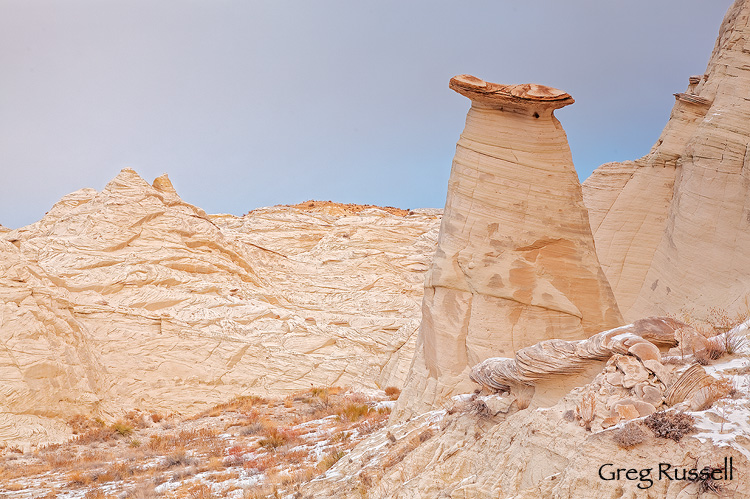
Despite relying somewhat on guidebooks, sometimes serendipity can strike in really sly ways.   In January, I followed vague directions to what is supposed to be a charming set of hoodoos in southern Utah.  From the parking area (a cow pasture), the directions I had told me to “walk up the canyon for an additional mile to the hoodoos.”  The problem is that there were two canyons.  Which way to go?

It turns out I chose wrong, and the hoodoos were nowhere to be found, even after more than a mile of walking.  I ended up at the head of a canyon that I would bet only ranchers and cows have been in for a very long time.  However, I was able to find some badlands, and one hoodoo, and I ended up really loving this image–not a bad “consolation prize” at all.

Hoodoo near Church Wells Badlands in southern Utah
Church Wells, January 2011

I guess all of this is a roundabout way of saying that even though its okay to follow directions to beautiful places, don’t be afraid to wander up the wrong canyon now and then.  You might just be delighted with what you find.


An Honest Silence

Friday, March 4th, 2011

In my blog post, “Topophilia,” an essay about the value of the desert southwest, particularly southern Utah, I wrote that I, “feel connected with the land in a way that words cannot describe.”

Indeed I do.  Some people may contend that the wild canyons and plateaus are dangerous; yes, Mother Nature can be treacherous–violently so.  However, despite that, I find sanctuary in the sandstone, a place of refuge and rejuvenation, of clarity and healing.  How can I find words to describe this place?  I may not ever be able to do it justice.

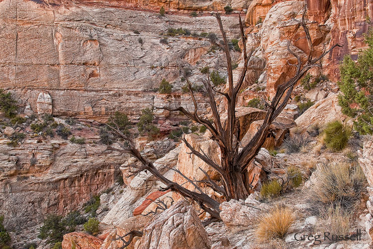
Canyon and cedar snag in the grand staircase escalante national monument, utah

Cedar Snag, Grand Staircase Escalante National Monument, August 2009

Last week, I met Ann Marie Whittaker through her blog, “Age Old Tree,”  and discovered her prose about why she loves her Red Rock Wilderness.  In a brief email exchange, I could sense a profound sense of place and love in her voice for this beautiful slickrock desert so many people fall in love with.  We need more people like Ann Marie in this world; I hope you go to her blog and read the post over and over (make sure to check out part two as well).  You’ll be inspired; I am, and I learned that its actually okay to embrace an honest silence about a place.

I’m still not sure what I want to say about southern Utah, but I’m very happy its there, and that its loved by so many.

beautiful and colorful sandstone formation, with calcite, southern utah

Sandstone Kaleidoscope, January 2011

The Sandman’s Castle

Wednesday, February 9th, 2011

Often, the best traveling companions have a lot to teach you.  My friend Brent is one of those guys.  I can’t remember a trip with him where there wasn’t some sort of field guide pulled out for most of the drive, and I was busy learning about the natural history or some other facet of the land.  On one road trip to Utah, we had the “Roadside Geology of Utah” out for 90% of the drive.  Although I got tired of the updates at every mile marker, I have to admit that I missed Utah (and the updates) when we crossed the state line into Arizona.  I definitely learned some geology on that trip, and I have a greater appreciation of it now.

Geology, as a science, studies the forces responsible for shaping and changing the earth.  Sometimes those shapes and changes can simply be otherworldly.  On my recent visit to the Vermillion Cliffs-Paria River Wilderness in northern Arizona, I was able to witness the magnificent results of some of these forces firsthand.

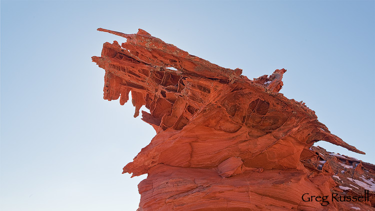
On a hike early one morning, we found ourselves on a small sandstone plateau.  The sandstone was beautifully colored, but what really grabbed my attention were the bizarre rock formations.  They reminded me of some petrified prehistoric gargoyle or ruins of an ancient civilization.

Sandstone formation in the coyote buttes north, arizona

Gargoyle, January 2011

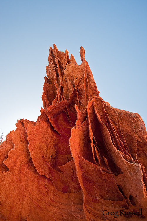
What’s happening in this image (and the one below) is called boxwork.  The idea is that the sandstone was fractured at some point, and then some sort of fluid intruded and precipitated out, but it was more completely lithified so the surrounding rock eroded before the boxwork.  I’m not entirely sure what intruded (calcite?), but it does make for very cool formations.  I hope you enjoy the images.

Sandstone boxwork in the coyote buttes north of northern Arizona

Broken Cathedral, January 2011

Photo of the Month–February

Tuesday, February 1st, 2011

January is already over, and the sun is starting to creep more and more northward in the sky every day.  Photographically, January was productive, and I’m excited to share some new images with you in the next couple of weeks.  February’s image of the month is an intimate landscape from a wildly popular location on the Utah-Arizona border.  During the first week of 2011, we traveled to Page, Arizona to visit the Paria River-Vermillion Cliffs Wilderness.  Never heard of it?  Perhaps not, but I’d be willing to bet you’ve seen images from it.  The area’s crown jewel is “The Wave,” which draws huge numbers of tourists every year.

We began our trip by hiking into The Wave, and it holds up to its expectations: its stunning.  The Wave and surrounding Coyote Buttes North has some of the most striking geological formations in North America.  It should come as no surprise, then, that The Wave is also heavily photographed.  Confined to a small area, I think it would be nearly impossible to come up with a novel composition from The Wave itself.  While there, I snapped a few images, and enjoyed the surrounding area.  It may sound like heresy to some people, but I enjoyed some of the alcoves around The Wave more.  In fact, judging by the paucity of footprints, I found some fantastic locations that seem to hardly get visited just a few hundred feet away!

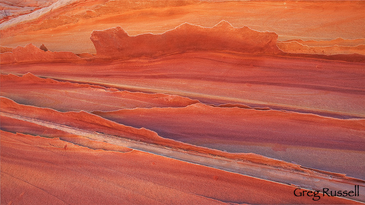
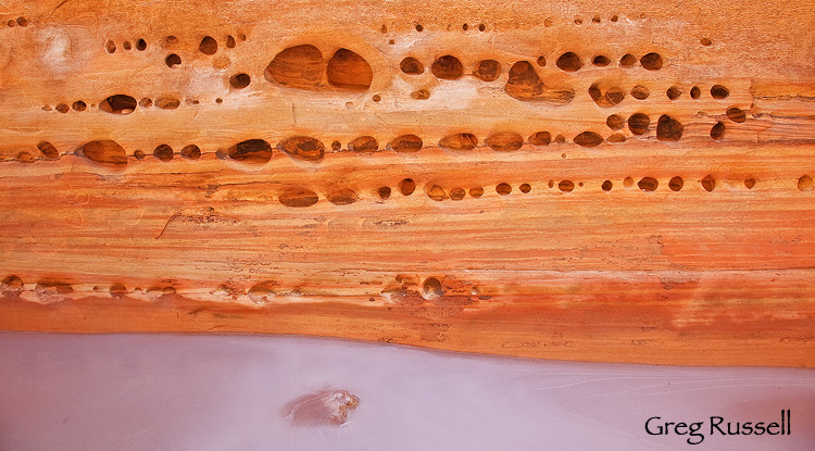
After enjoying this lovely area, we visited some other canyons in the area, and that’s where I found this month’s image.  One of the things I’ll blog about soon is the diversity of sandstone in this area–amazing, whimsical formations and colors abound.   I really liked the way the sandstone “windows” here contrasted with the ice below.  I hope you enjoy it too.

Also, I wanted to mention that yesterday I had the honor of being featured by David Hyde over at the Landscape Photography Blogger.  Over there, David primarily showcases the work of his father, Philip Hyde, the pioneering color landscape photographer.  Head on over and check out the feature as well as some of David’s other blog posts.  I think you’ll quickly learn that if you don’t already read regularly, you’ll want to.

Sandstone and ice in Buckskin Gulch, Paria River-Vermillion Cliffs wilderness, Utah.

Ice underneath, January 2011

Those who passed before me

Monday, January 24th, 2011

Have you ever imagined what the first people who walked into a place as grand as Yosemite Valley, or a beautiful remote canyon in Utah must have thought?  Unless they wrote their thoughts down, we can’t be sure, but I’d imagine it was something along the lines of “Holy Crap!”

Being the first person to see a place must give a grand sense of accomplishment.  But, similarly, seeing something grand for the first time–whether you’re the discoverer or not–can also be satisfying.  Perhaps you’re the first visitor of the season, knowing the canyon you’re in was left to the mountain lions, flash floods, and snowstorms for many months prior to your visit.  Or, maybe you’re witnessing your favorite peak after an epic summer storm being lit up by a fantastic atmospheric light show.  The sort of feelings and memories we take from experiences like this can easily leave us feeling like the most intrepid explorer.

As photographers, we try to make images of the places we visit as if we were the first to visit these locations.  We criticize an image if there are footprints in the dirt; I once saw another photographer carefully sweeping footprints out of the sand underneath an oft-visited arch in Utah.  Few photographers could claim theirs is the first image made at that spot (with the occasional very notable exception), but we want our image to look pristine, unvisited, wild just the same.

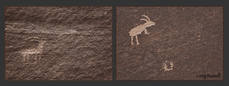
Alternatively, for me anyway, knowing I’m not the first person to pass through a place can be just as satisfying.  I made the images below at an intersection of two slot canyons in southern Utah recently.  (I think) the petroglyphs are from the Fremont period, from ~900-1300 AD (although if anyone could help me figure this out, I’d appreciate it); even if I’m wrong, these drawings have been on the wall of this canyon for many hundreds of years.  To me, being able to appreciate those who passed before me is just as satisfying as the idea of actually being the first to see an area.

This image may not be everyone’s cup of tea, and I understand that.  But, to me, its simple, telling, beautiful.  I hope you enjoy it.  Click on the image to see it big.

Petroglyphs located in Buckskin Gulch, Utah

Petroglyph Diptych, January 2011

Photo of the Month–September

Wednesday, September 1st, 2010

As I learn more post-processing techniques, I’ve been enjoying going through several of my older images on this website and adding some “finishing touches” to them.  This is a nice exercise because it allows me to re-evaluate images, as well as take my own trips down memory lane.  If I combine this with the fact that several close friends have taken trips to southern Utah in the last few months, I am reminded how I feel about that place.  So, September’s photo of the month is from the summer of 2009, when I visited the Grand Staircase-Escalante National Monument.

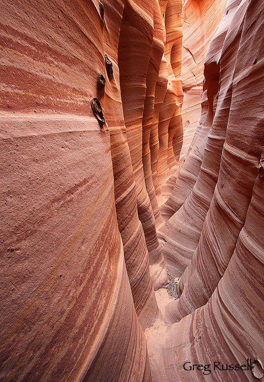
Zebra Canyon is a fantastic slot canyon located in the northern part of the monument, and is extremely photogenic.  Shooting in Zebra Canyon was something I envisioned for almost 2 months before the trip, so I was happy to finally get the chance to visit the location in August 2009.

zebra slot canyon, grand staircase-escalante National monument, utah

Zebra Canyon, August 2009

You can see all of my photos from the Grand Staircase-Escalante National Monument by clicking here.  Here’s to trips down memory lane.

Have a great month!