utah

...now browsing by category


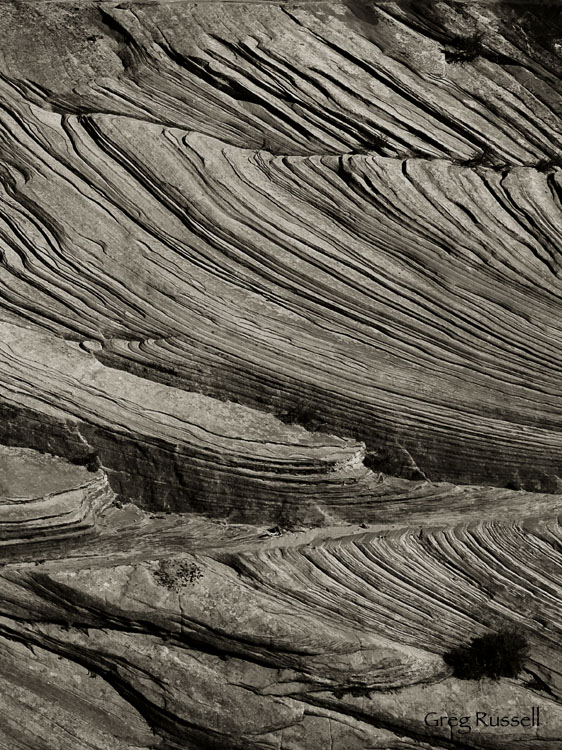
Cross bedding abstract, Zion National Park

Thursday, January 14th, 2010

Sedimentary rocks are normally deposited as horizonal layers. Even when folded or tilted by faulting the originally horizontal layering is obvious. Upon closer examination, however, you may see very fine layers (usually 1 to several mm thick) that are at an angle to the main bedding. These tilted layers contained within larger layers are termed cross bedding.

What a mouthful right?  As sandstone is formed, sand is laid down, either by prevailing wind current, or water current.  However, over geologic time, those currents shift, causing sand to be laid down in a different direction.  What you get is cross bedding.  I love all the cross bedding in Zion National Park and thought it would make for a good abstract photo.  To make this, I intentionally underexposed the photo by ~1 stop, to emphasize the shadows, then I converted to black and white in Photoshop and applied a very light tint to the image.

Cross bedding abstract photo, Zion National Park, Utah

Cross bedding abstract, Zion National Park, January 2010

You can see all of my Zion National Park images here.

New images, and a new page

Monday, January 11th, 2010

Yesterday I returned from what felt like a whirlwind 4-day trip to Utah.  Our plan was to head into the Vermillion Cliffs wilderness and visit the Wave, as well as Buckskin Gulch and Wire Pass.  Unfortunately, December snow and recent warm temperatures have made the roads into those trailheads extremely muddy, and nothing ruins a trip faster than having to call a tow truck to pull you out of the mud.  As a compromise, we spent a couple of days in Zion National Park, as well as one day in Bryce Canyon National Park.  I’ll be sharing some images from those parks in the next few days.

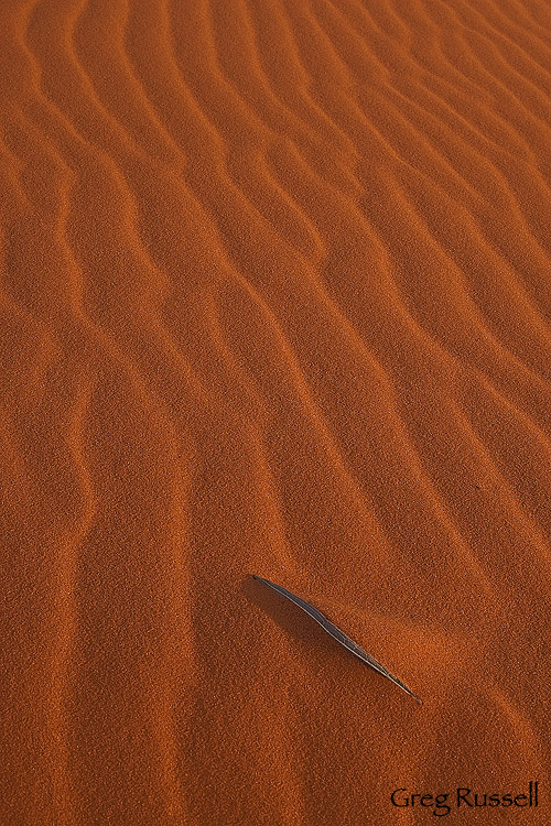
On our second night there, we made a trip to Coral Pink Sand Dunes State Park near the east entrance to Zion.  I had never been here before, but because of my love for sand dunes I’ve always wanted to.  The geography of the region has allowed the dunes to form here, and the sand is derived from Navajo Sandstone which surrounds the area.  As the name implies, the dunes were very pretty pink, turning a brilliant red as the sun went down.  With the Vermillion Cliffs as a backdrop, this place would make for some great grand landscapes, however I was somewhat disappointed with the number of OHV tracks on the dunes (for grand landscapes, it would be best after a large wind storm).  In the spring, the place would also make for great floral photography.  On this trip, however, I focused on the macro landscape.   I hope you enjoy this image; its one of my favorites from the whole trip.

coral pink sand dunes, utah state park, utah department of natural resources, abstract image, sand dune pic

The Sands of Time, Coral Pink Sand Dunes, January 2010

My 5 favorite images of 2009: #1

Wednesday, December 30th, 2009

The hardest thing about the last 5 days has been picking out 5 of my favorite images from this year.  Obviously I like all the images on this website, or I wouldn’t share them with you, but I like them all for different reasons.  Some were images that I envisioned for weeks (or even months) before getting the chance to make them, so I was happy when the shot came together.  Others were ones I associate memories with; I was able to shoot with my dad (who lives 750 miles away) a few times this year, and other times I had my wife and son with me.  The memories are what make those images some of my favorites, not so much whether they’re technically perfect.

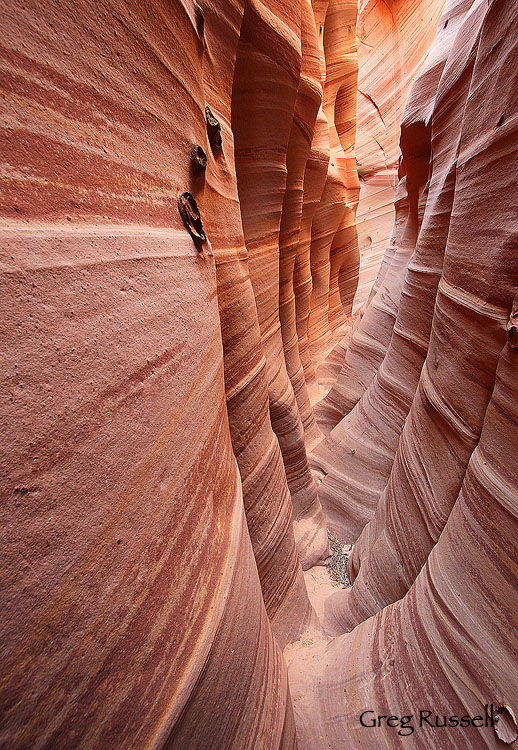
Today’s image also comes from Utah’s Grand Staircase-Escalante National Monument.  Shooting in Zebra Canyon was something I envisioned for almost 2 months before the trip, so I was happy to finally get the chance to visit the location in August.  You can read about photographing inside of Zebra here.

Zebra Canyon, August 2009

Zebra Canyon, August 2009

You can view my four other picks for 2009 here, here, here, and here.   My family and I are leaving tomorrow morning to celebrate the new year (and incidentally, new decade) in Yosemite National Park.  I hope 2010 brings you happiness, health, and fantastic light!  Many warm wishes.

My 5 favorites of 2009: #3

Monday, December 28th, 2009

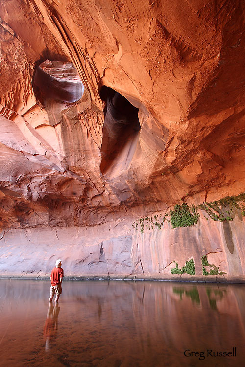
The next image in my year-end lineup includes a human element.  In August, we visited the Grand Staircase-Escalante National Monument in southern Utah.  Although my “day job” allows for plenty of photography time, my days off to shoot either lie in the heat of summer, or the dead of winter.  Thus, visiting the Escalante in August, was…um…hot.  But it was very worth it.  On our second day there, we decided to visit a feature known as the Golden Cathedral.  Getting there is not really tough–it involves about 5 miles of cross country hiking, but getting there is all downhill.  Plus, once you’re in the floor of the canyon (the last mile) you’re protected from the heat of the day.

We spent about 1 hour shooting in the Cathedral, but my favorite shot to come out of the day was one I took of my friend Brent, who was kind enough to stand still for all 3.2 seconds this exposure took.

Be sure to check out my first two images of 2009 here and here.

Inside the Cathedral, August 2009

Inside the Cathedral, August 2009

My 5 favorites of 2009: #4

Sunday, December 27th, 2009

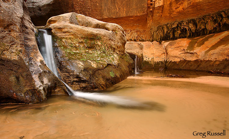
My 4th favorite shot of 2009 comes from Zion National Park.  Over Labor Day weekend, my dad and I hiked through the Subway, from top to bottom with all of our camera gear.  Earlier that day I had slipped while descending into the left fork of North Creek and very nearly took a spill off of a ~150′ cliff (it really was the most scared of actually dying I’ve been in the backcountry), but despite that (and what I think is tiny–but painful–bone fragment still floating around in my elbow), it was a fantastic day.  I double-drybagged all of my camera gear to keep it dry on the swims, and it was worth it when we came to the beginning of the Subway.

My fourth favorite image of 2009 is one many Subway hikers don’t get to see because there’s a rappel standing in their way.  The first cascade in the system is not as magnificent as the others, but it had an Eden-like feel to it.  I feel this shot does a good job of portraying that feeling.

Inside the Subway system, Zion National Park, September 2009

Inside the Subway system, Zion National Park, September 2009

I think one of the best parts of this image for me is the swirl of leaves in the lower left hand corner.  I hope you enjoy it!

Remember that you can receive 30% off of prints of any or all of my favorite images through January 15.  Also, be sure to check out my first choice for image of the year here.

The Rise

Monday, December 14th, 2009

Today’s post comes from my new friend and fellow photographer Jay Goodrich.  After reading my post on Topophilia, Jay contacted me with his interest in contributing a story about how the landscape of southern Utah has touched him.  You can read his story, The Rise, below, as well as enjoy some original images from Jay.  Additionally, make sure to check out Jay’s photographs here, and subscribe to his blog here.  Thanks Jay!

The Rise © Jay Goodrich

I stand in the middle of a valley surrounded by rock formations. I can not see any of them yet, but I know they are there. It is so dark that I can not even tell if there are any clouds lingering to add to the drama of photography this morning. Red earth all over my shoes, my clothes. It is in my hair, my nose, my ears, and even my eyes. It was a little windy yesterday. I look to where I think the horizon is but I see nothing but a big black void. There is not a soul around, it is completely silent. I am for once, early. I head to the back of my truck to grab my backpack and my tripod. The rear bumper is covered in a layer of red powder about an eighth of an inch thick. I write “wash me” in it. As I open the door the dust stirs into little tornados before it falls back to the earth. My pack and tripod have traces of the deep maroon powder all over them as well. I stumbled upon this place yesterday afternoon.
jgtr2

I am a bit tired. I spent the evening shooting star trails only to realize that morning was going to come way too soon. There is a crispness in the air, it tingles as it enters my nose. It reminds me of that sound you hear when a person bites into the perfect fall apple. A little pop, followed by a sweet aroma; I can just taste the explosion of flavor. Vapor crystals leave my nostrils and mouth and scatter as far as I can see. I hope that my mission is going to yield imagery that ties over my soul for awhile – this is my last day here.

I pull the Petzl lamp out of my pack and wrap it around my head. I turn it on, throw the pack onto my back, adjust the straps and buckles, sling the tripod onto my shoulder with one hand, and close the truck door with the other. More dust scatters. I start to walk into the belly of monuments and darkness. I am now the only light source.
jgtr5

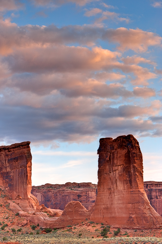
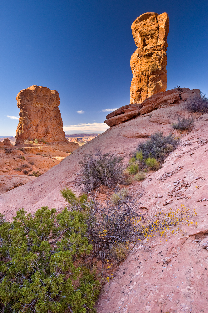
As I stumble to my location, a calm comes before me. It was like I donned that old comfortable shoe that was completely molded to the contours of my sole. I began to run on auto pilot. The light was starting to fill the sky. At least, enough that I could see those rock formations. They were looking a little pink. This place is so magical. I knew that would change as the sun began its race to the other side of the planet. It always starts as pink, or tan, something very subtle and muted, pastel. And depending on the atmosphere, the day could become, gold, yellow, orange, red, crimson, maroon, or any variant there of, a perfect contrast to that deep blue fall desert sky. The formations – sharp and jagged to smooth and bulbous. Why this place over any other? The mountains are my home, but this place speaks to me like no other.
jgtr6

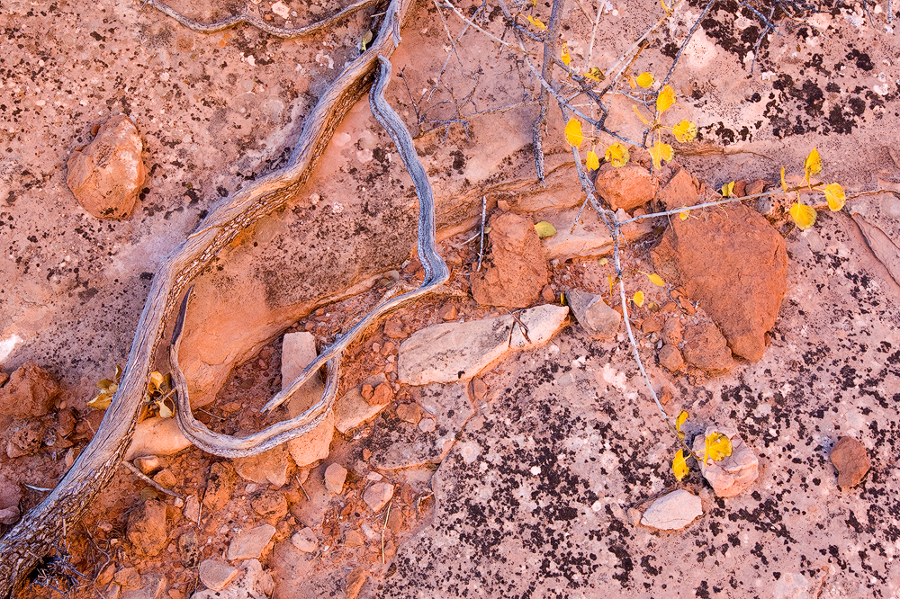
As the sun begins to come up there is a slight breeze. It is the souls of those rock formations coming alive, they are looking for warmth as am I. The hair on the back of my neck stands on end, like it does when I feel the gentle kiss of my wife. My pupils dilate. I feel the eye muscles tighten. The sun is showing her face ever so slightly. The warmth begins to bathe me and all of my surroundings. The crystals from my breath fall away closer to their origin. I quickly realize It is going to be a golden rise. Everything is covered in hues of yellow and orange. I look through my viewfinder one last time. God I love this place. And click.
jgtr1

More images from Cedar Mesa

Friday, December 11th, 2009

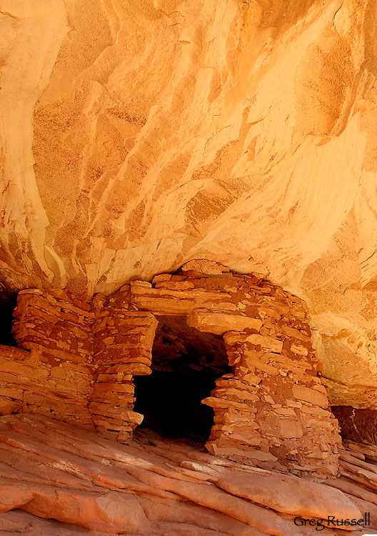
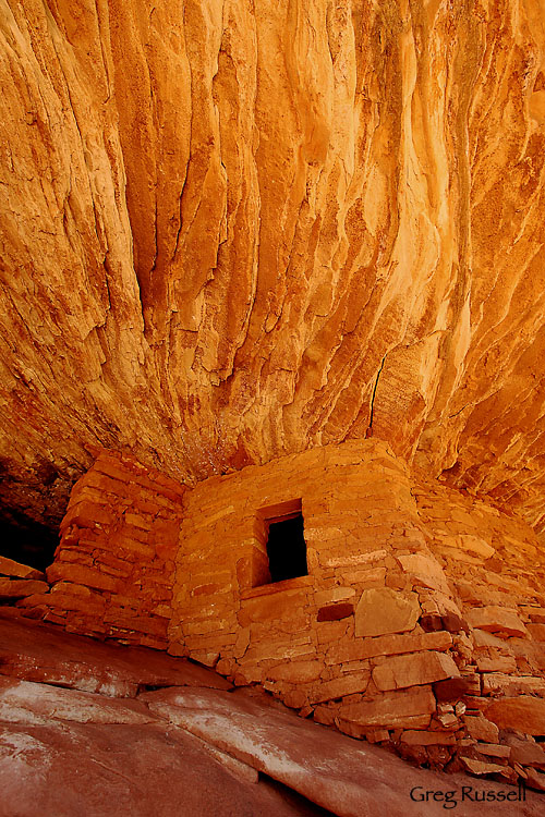
I’d like to share a couple of more images from my recent trip to Cedar Mesa, in southeastern Utah.  The first one is an Anasazi, or Ancestral Puebloan, granary that’s immediately adjacent to the more famous Flaming Roof Ruin.  I love the way the doorway has “shaped” itself over the years into a unique symmetry, and you can still see the same patterns on the roof of the alcove, giving it a “flaming” appearance–maybe this is Flaming Roof Ruin II?

Anasazi Granary II, November 2009

Anasazi Granary II, November 2009

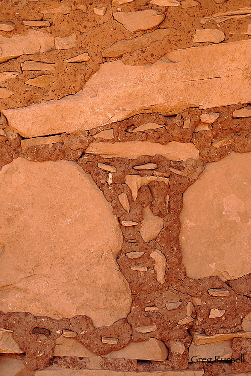
In addition to being impressed with the entire structure, the masonry work itself is also very interesting to look at, and I thought a detail of a granary wall would make an interesting photograph.  These structures were likely abandoned around 1300 AD (perhaps earlier), and they’ve managed to survive 700+ years in good shape.

Granary Wall, Detail, November 2009

Granary Wall, Detail, November 2009

Black Friday

Thursday, December 3rd, 2009

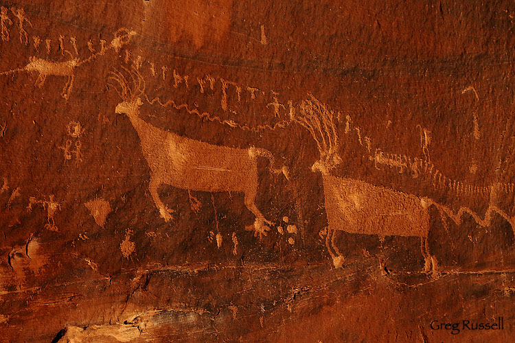
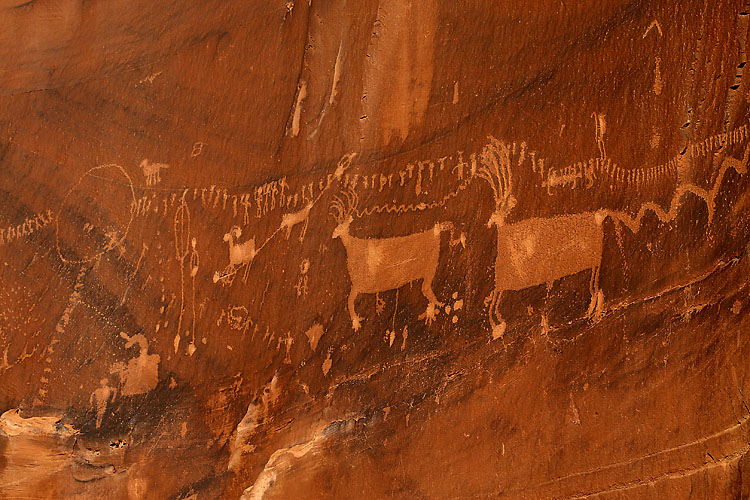
While 1000s of people chose to get their post-Thanksgiving exercise by shopping the deals in our nation’s shopping malls, I escaped to southern Utah.  I recently shared a photo from the Ancestral Puebloan ruin I visited, but I was also able to visit a petroglyph panel known as the Procession Panel, which is located on Comb Ridge, west of the town of Bluff.

Procession Panel, November 2009

Procession Panel, November 2009

The panel, about 15 feet long, consists of multiple lines of people and animals “marching” towards a central point (visible below).  Two of the most interesting figures (above) are deer; the left-hand deer has an atlatl (basically a spear “thrower”) dart sticking out of its abdomen and the second one has a long tail that morphs into a snake ready to strike.  I wasn’t able to capture the entire tail in either of these photographs.  Archaeologists and Anthropologists who study the Anasazi culture have speculated on the meaning of this panel.  Was it a funeral procession?  Does it signify the event that caused the Ancestral Puebloans to leave the area abruptly?  Obviously we can never be really sure, but I’d like to suggest that it does NOT signify the people lining up outside of Wal-Mart for the best Black Friday deal on an LCD TV.

Procession Panel, November 2009

Procession Panel, November 2009

I’d also like to direct you to my new Cedar Mesa Page, showing all of the photos from my recent trip to Utah.  Enjoy!

Cedar Mesa, Utah

Sunday, November 29th, 2009

We just returned from my parents’ house in New Mexico, and in classic Topophiliac fashion, I made a quick day trip to the Cedar Mesa in southern Utah.  As a best estimate, it had been 9 years since I last visited this area, and returning only confirmed for me that it really is one of my favorite places to be.  Since I only had one day, the locations I visited were a little cliché and iconic, but it satiated my soul.  

I made my first visit to the ruin known as “Flaming Roof Ruin” or “House on Fire Ruin”.  It really is beautiful, and humbling, to be able to spend a couple of hours in such a historic location.  


Flaming Roof Ruin, November 2009

Flaming Roof Ruin, November 2009

I’ll have more posts from this amazing ruin, as well as other locations on my day trip in the next few days.  Getting to spend the day on Cedar Mesa with my Dad was one of the many things I was thankful for this last week.  I hope you were able to celebrate everything you’re thankful for this year…

Featured Photographer–Bret Edge

Wednesday, November 18th, 2009

Bret is the third featured photographer in my series on Topophilia, finding your sense of place in the canyons of southern Utah.

As I mentioned in a previous post, one of the reasons photographers seem drawn to southern Utah because of the solitude.  According to the US census department, the population density in San Juan County, Utah in 2000 was 1.8 people/square mile.   Parts of southern Utah have some of the darkest night skies in North America.  So, that solitude isn’t an illusion–you really can be the only person for miles.

One of the reasons I admire Bret Edge’s photography so much is that he has a knack for capturing that  vast solitude without making you feel lonely.  A look through his portfolio has many images that interpret the expansive landscapes of southern Utah in a very real and tangible way.

I first met Bret late in 2008 through interactions on Naturescapes.net; he offered a ton of helpful advice as my wife and I planned a short trip to Moab after Christmas.   Since then, I’ve appreciated his honest, thoughtful and constructive feedback on my own and other photographers’ images.  Although not a Utah native, Bret has the pleasure of living in Moab, and by his own confession, he is practically addicted to the area.  He and his wife moved there almost 4 years ago, and have embraced the landscape (he proposed to his wife under Delicate Arch!)…and its embraced them.  Bret says, “Funny how Moab and the Southwest just kind of grabs hold of you and doesn’t let go.”

From his home base in Moab, Bret offers dynamic workshops and photo tours (which you can read about here) in the Moab area and beyond.   In addition to registering for one of his workshops, make sure to subscribe to his blog for trip reports, new images, gear reviews and workshop updates.

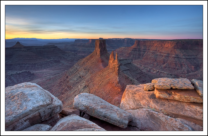
Canyonlands Sunrise by Bret Edge (used with permission)

Canyonlands Sunrise by Bret Edge (used with permission)